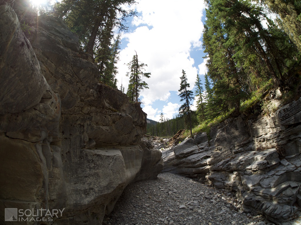
Nihahi Creek
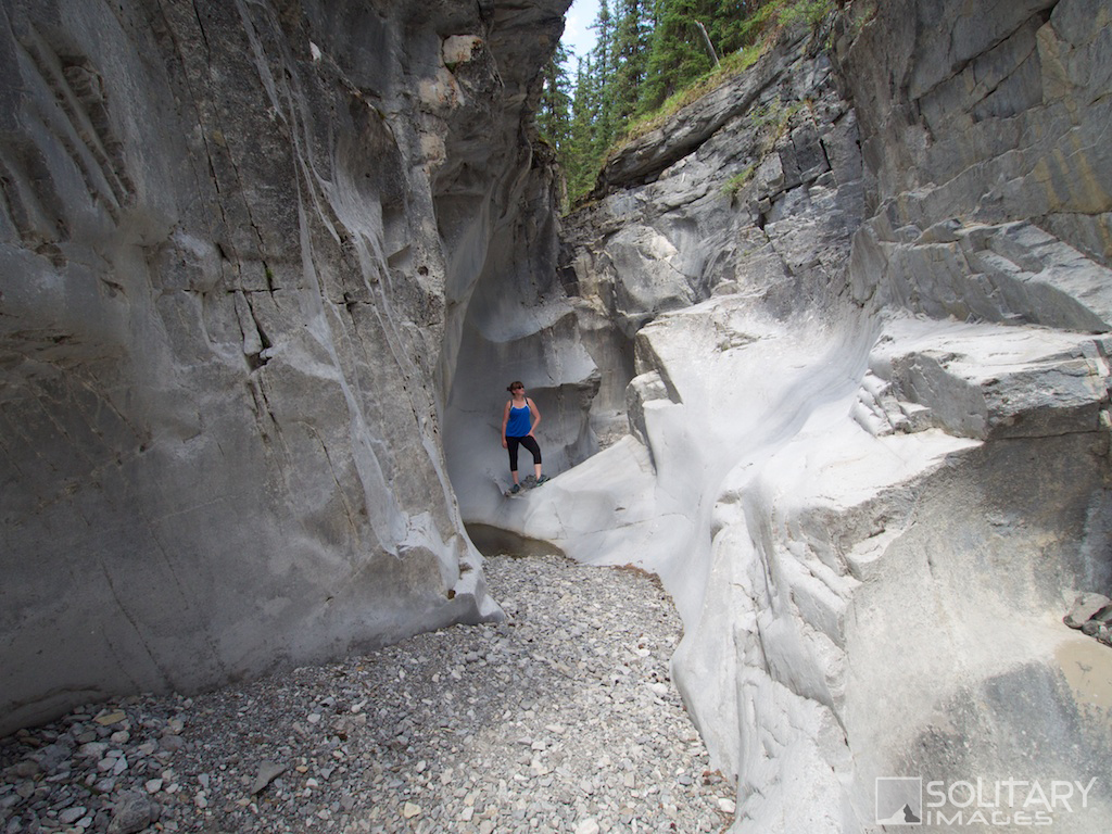
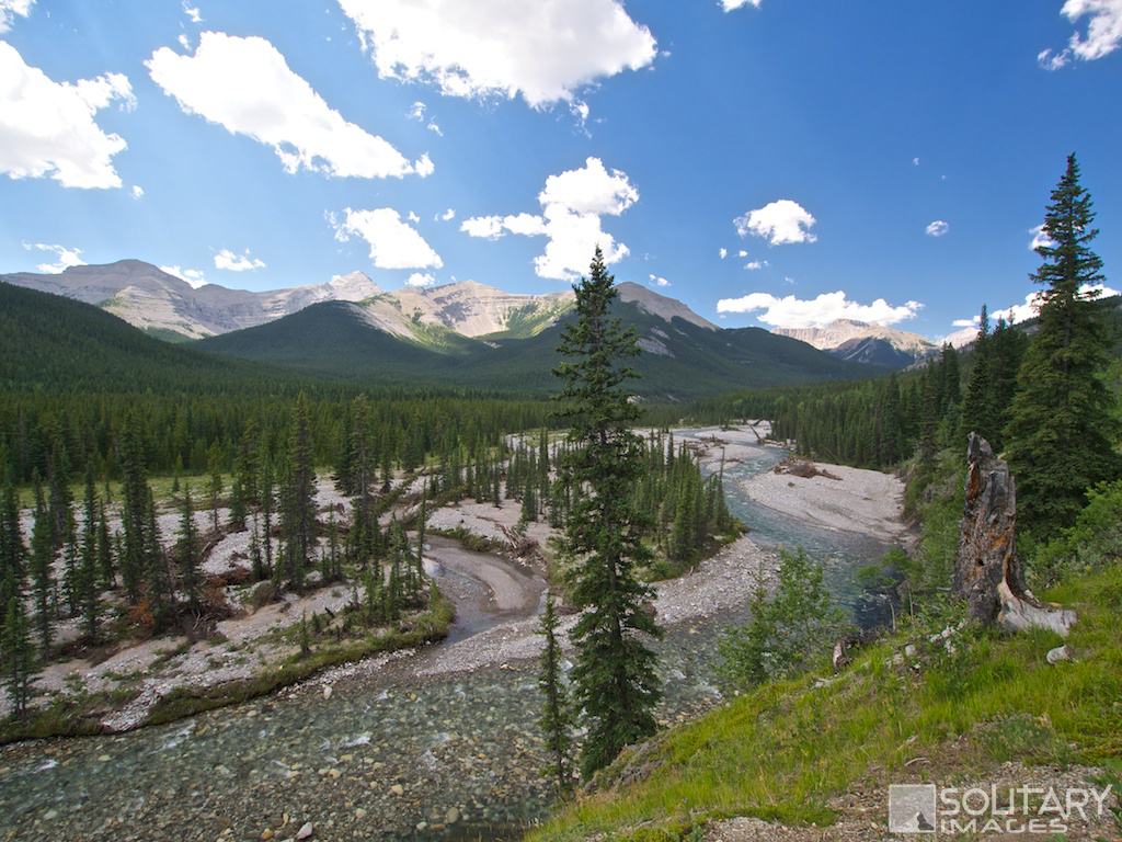
A peaceful hidden adventure land carved out of limestone bedrock and hidden in a vanishing river valley. This hike is an excellent retreat during those hot summer days. During the spring runoff, the canyon will be filled with water running off of the surrounding mountainsides and will be inaccessible.
Nihahi Creek
Distance: 13.1 km return Elevation Gain: 197 m Total Elevation Gain: 285 m Physical Difficulty: 2/5 Technical Difficulty: 3/5 Time: 3-5 Hrs 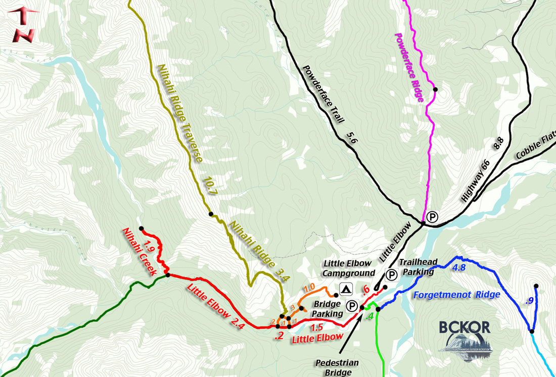
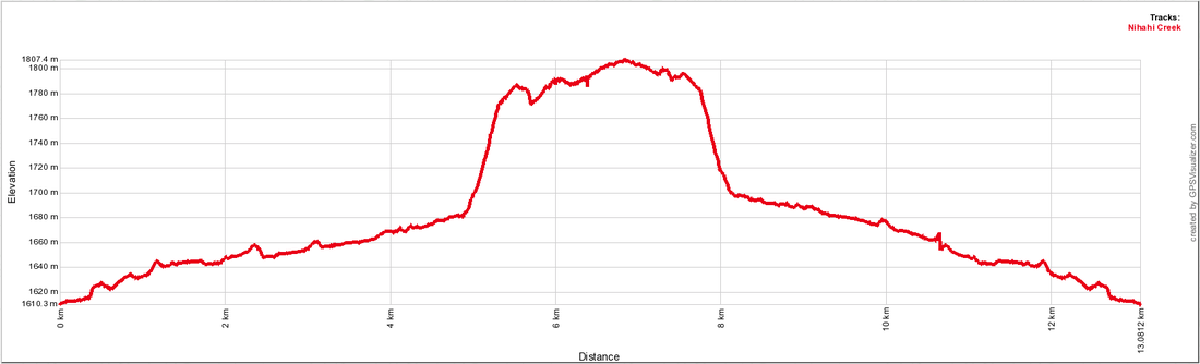
Nihahi Creek Profile
|
To Get Here: From the 4 way stop on HWY 22 next to Bragg Creek, take HWY 22 south to a T intersection. Turn right (westbound) on HWY 66. Travel 27.5 km to the intersection of Hwy 66 and Powderface Road. Turn left towards Little Elbow Campground and park in the Trail-head parking on your first left past Forgetmenot pond.
This section of HWY 66 is closed between Dec 1 to May 14 Trail Description:
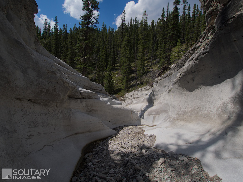
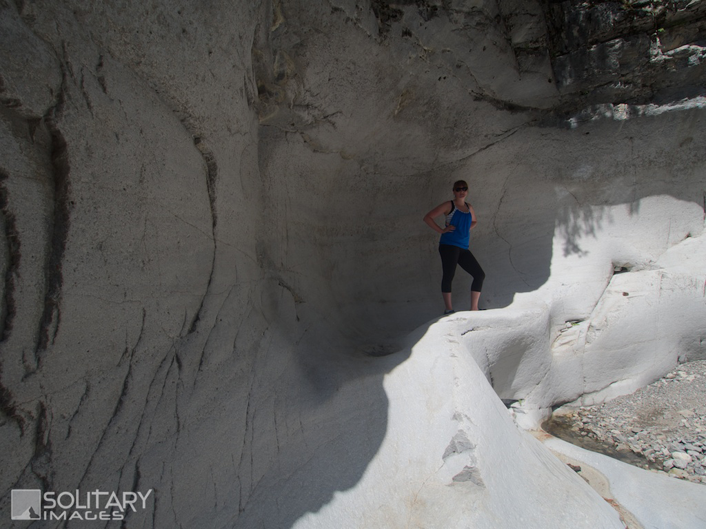
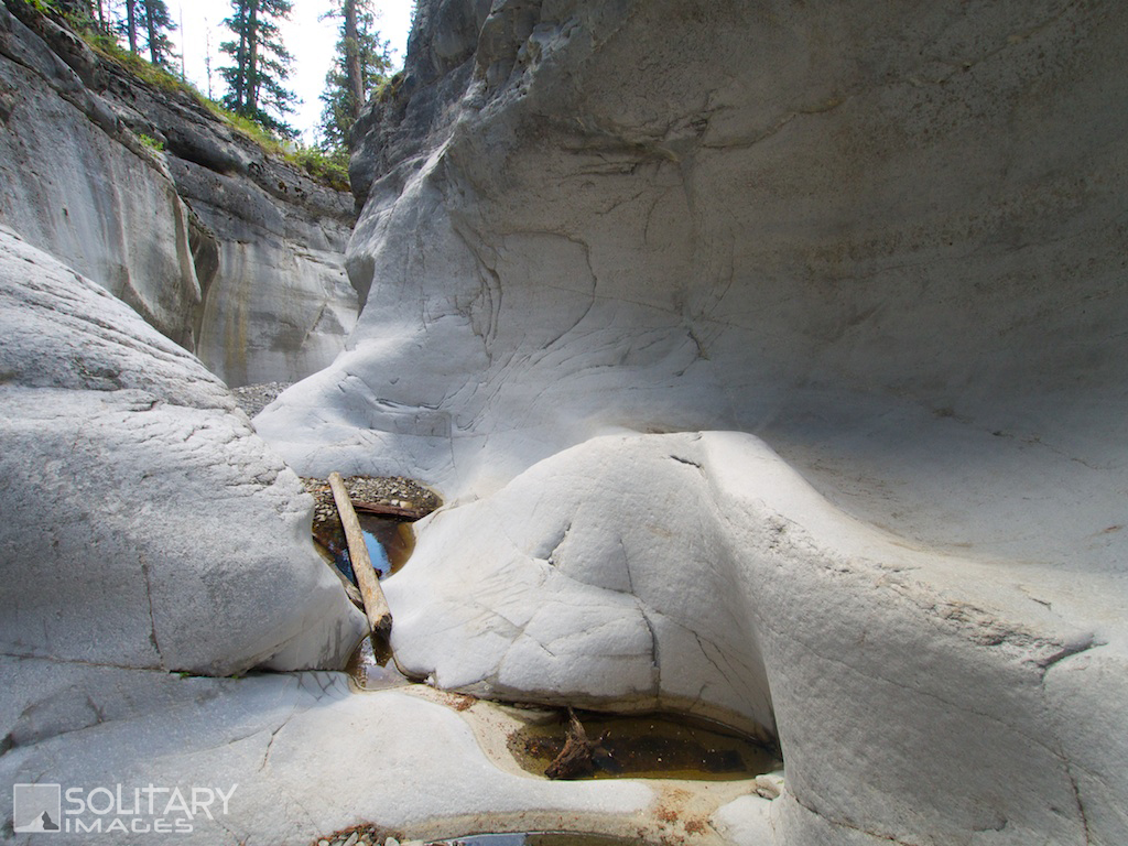
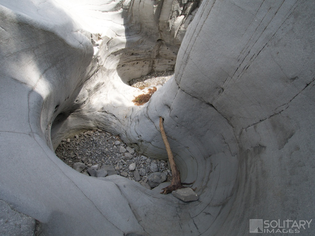
From the Trail-head Parking lot, start SW alongside the Elbow River on Little Elbow Trail for 600m. The flood of 2013 has washed out some portions of this trail and you will need to make your way up the bank onto the roadside for a portion of it. There is parking next to the bridge but it is often full. 450m past the bridge, the Little Elbow Trail joins the campground road. Continue on the road past a locked gate to the Little Elbow trail sign. Stay on Little Elbow Trail for 4.1km past the two Nihahi Ridge turnoffs and along the flats, next to Little Elbow River. The Nihahi Creek turn off is on your right just before crossing the Nihahi Valley drainage, which may or many not contain Nihahi Creek. If the creek is present, the canyon will be inaccessible. The trail climbs steeply through the forest alongside Nihahi Creek with many viewpoints overlooking the valley. After 750m, look for the canyon entrance on your left next to a wide gravel fan. A faint trail leaves the main trail and an easy scramble brings you into the Canyon entrance. Wander through the smooth artistic carvings, scrambling over dry waterfalls and large pools, until the canyon surfaces in an open gravel river bed. From here, you can rejoin the trail that runs on the Canyon's eastern bank back to the trail head, or continue wandering down the Nihahi valley for added adventure. | ||||||||
Return to Bragg Creek Area Hiking/Running Trails (click here)
Return to Hiking/Running Trails (click here)
Return to Hiking/Running Trails (click here)