Bragg Creek Picnic Sites
Bragg Creek Provincial Park

A peaceful spot next to the Elbow River. Spend the day relaxing at the open picnic areas, listening to the river's lisping gurgle. If you want to stretch your legs, a short 1.5km interpretive trail loop starts at the far south end of the parking lot and travels across White Ave, to the south west corner of the park. If you suddenly have a craving for ice cream or dinner, the Centennial hiking trail winds 2 km along the Elbow River to White Ave in Bragg Creek.
|
To Get Here: From the 4 way stop on HWY 22 next to Bragg Creek, Take White Ave South West for 2. 4km. The park entrance will be on your right hand side. Alternatively, park in the Hamlet and walk down White Ave to join the Centennial Trail just past the Trading Post, next to the Elbow River. |
HWY 66

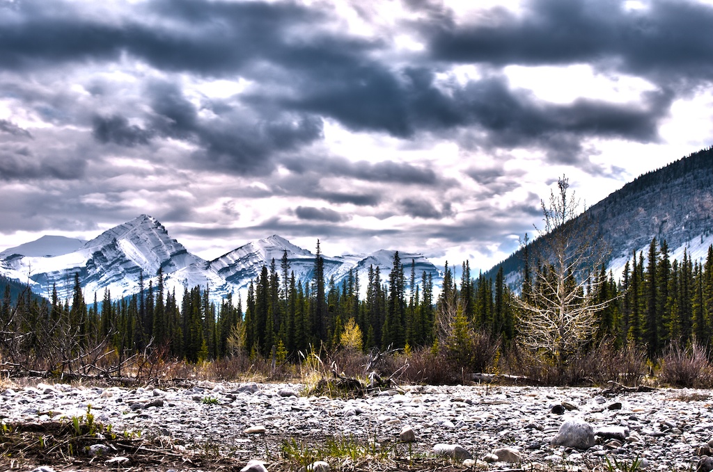
HWY 66 is Bragg Creek's showcase highway. It travels past numerous picnic spots, campgrounds, trails, and attractions. Travel up and over passes as you wind along the Elbow River in-between the mountain tops.
|
To Get Here: From the 4 way stop on HWY 22 next to Bragg Creek, take HWY 22 south to a T intersection. Turn right (westbound) on HWY 66. HWY 66 travels for 28km until terminating at Little Elbow where it joins Powderface Road. HWY 66 is closed between Elbow Falls and Little Elbow Recreation Area between Dec 1 to May 14 |
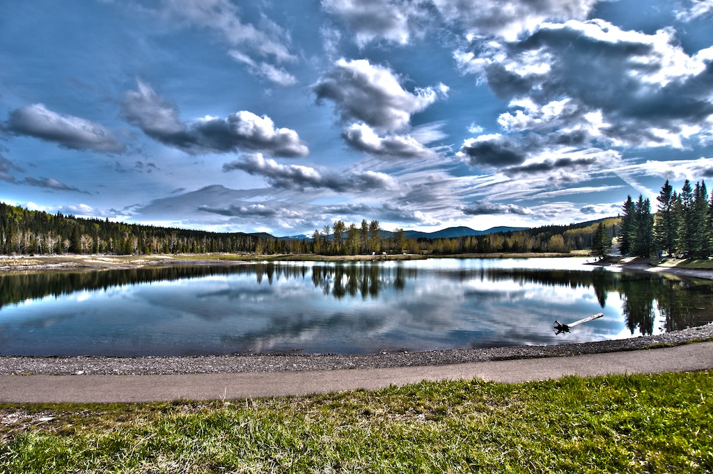
Allen Bill Pond
|
To Get Here: From the 4 way stop on HWY 22 next to Bragg Creek, take HWY 22 south to a T intersection. Turn right (westbound) on HWY 66. Travel 9.7km west down HWY 66 to the entrance of Allen Bill Pond on your left immediately after crossing the Elbow River. |
Elbow River Launch
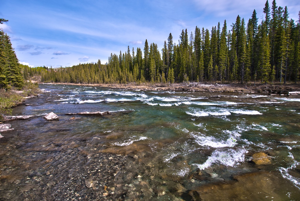
Designed as a boat launch and take out for white water paddlers. The Elbow boat launch is a peaceful getaway away from the highway complete with picnic tables. Watch the kayakers dodge rocks and bob through the waves, from the safety of the shore. If you're thinking of putting in, remember that there is significant whitewater downstream. If you're taking out, then I guess you know about the waterfall upstream. A guidebook and significant experience are required to safely run this river. For more info visit Paddling the Elbow.
|
To Get Here: From the 4 way stop on HWY 22 next to Bragg Creek, take HWY 22 south to a T intersection. Turn right (westbound) on HWY 66. Travel 16.2km west down HWY 66 to the entrance for Elbow River Launch on the left side at the bottom of the hill opposite Ing's mine. |
Elbow Falls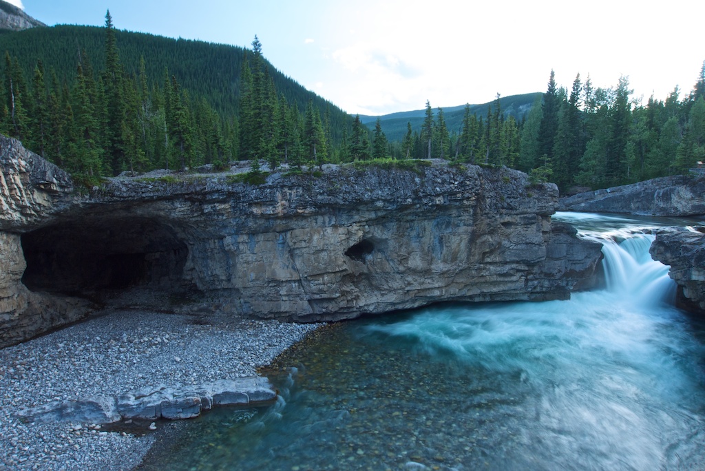
A picturesque waterfall right next to the road, located on the scenic HWY 66 in Elbow Valley. A short walk along a safe cement path with railings, will bring you to several viewpoints (trail description: click here). There are picnic tables scattered throughout the trees, where you can enjoy a peaceful lunch. A great afternoon escape from the busy city life!
|
To Get Here: From the 4 way stop on HWY 22 next to Bragg Creek, take HWY 22 south to a T intersection. Turn right (westbound) on HWY 66. Travel 18. 1km west down HWY 66 to the entrance for Elbow Falls. It will be on your left side just prior to the winter gates. |
The following areas are located beyond the gated portion of HWY 66
They are only accessible from May 15 - December 1
Beaver Lodge
A great spot to stop and wander alongside the Elbow River Valley where the beavers have changed the entire ecology through a series of Beaver Dams. This area doesn't provide a picnic area but is a great opportunity to stretch the legs in a completely different environment.
(Trail Description: click here) |
To Get Here: From the 4 way stop on HWY 22 next to Bragg Creek, take HWY 22 south to a T intersection. Turn right (westbound) on HWY 66. Travel 19km west down HWY 66 to the Beaver Lodge pull off on the left. |
Cobble Flats
A wide open area surrounded by mountains and hills. A peaceful stream flows next to the parking area and a short walk brings you out onto a large open plain. A great place to throw a football with the ultimate goal posts standing erect far off in the distance.
|
To Get Here: From the 4 way stop on HWY 22 next to Bragg Creek, take HWY 22 south to a T intersection. Turn right (westbound) on HWY 66. Travel 26.4km west down HWY 66 to the entrance for Cobble Flats on the left side at the bottom of the large steep hill. |
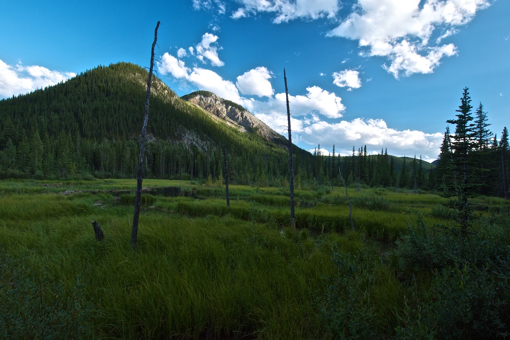
Forgetmenot Pond
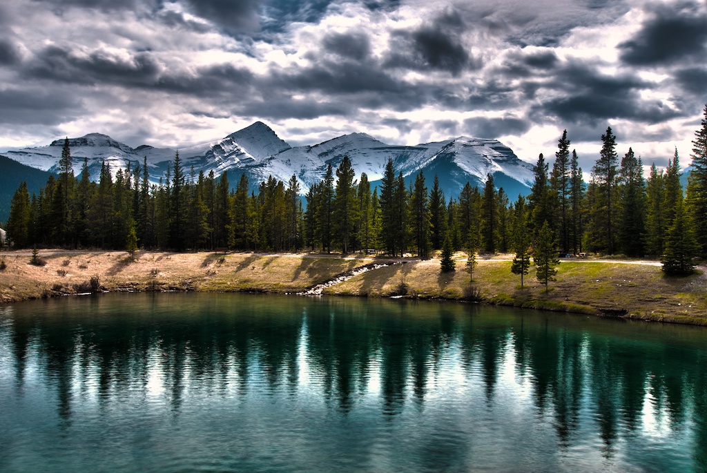
A serene pond located away from the highway. The deep green water, with the light grass and blue mountains rising up behind, creates the ultimate backdrop to a basket full of snacks and a frisbee session.
|
To Get Here: From the 4 way stop on HWY 22 next to Bragg Creek, take HWY 22 south to a T intersection. Turn right (westbound) on HWY 66. Travel 28.5km west down HWY 66 to the entrance for Forgetmenot pond on the left side at the end of HWY 66. |
Powderface Trail
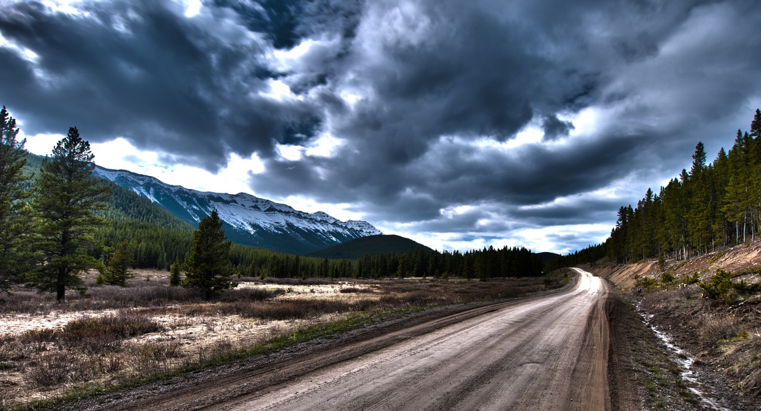
A windy dirt wagon trail that highlights the remote area of Bragg Creek. A wildlife lovers secret passage way. Follow this road as it winds alongside the Kananaskis range connecting HWY 68 in the Sibbald area with HWY 66.
|
To Get Here: From the 4 way stop on HWY 22 next to Bragg Creek, take HWY 22 south to a T intersection. Turn right (westbound) on HWY 66. HWY 66 travels for 28km until terminating at Little Elbow where it joins Powderface Trail. Powderface Trail continues north for 34.6km to connect with HWY 68 Sibbald Creek Trail. |
Our Lady of Peace Memorial
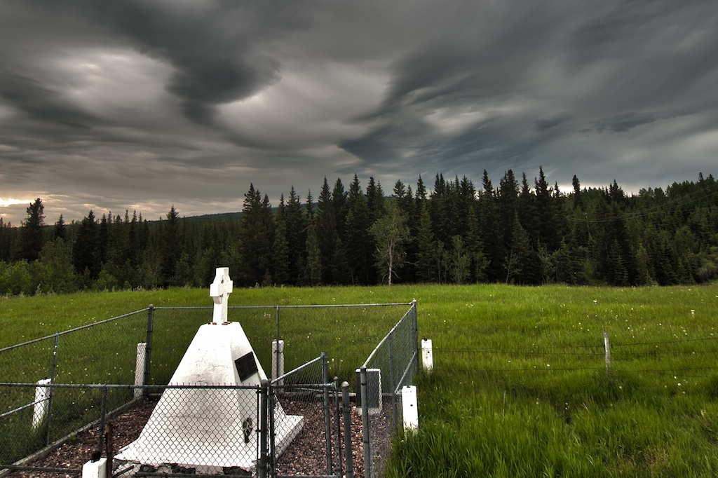
The Site of the First Church in Southern Alberta. Commemorating Irish Roman Catholic Priest's, Father Constantine Scollen O.M.I (1841-1902) and Father Leon Doucet O.M.I (1847-1942). They operated the mission while living and evangelizing among the Blackfoot.
|
To Get Here: From the intersection of HWY 8 and HWY 22, take HWY 22 North for 1.6km. Take your first left onto TWP Road 242 and follow it for 1.6km. Take your first left again on Range Road 43 and follow it to the end. |