Forgetmenot Ridge & Forgetmenot Mountain
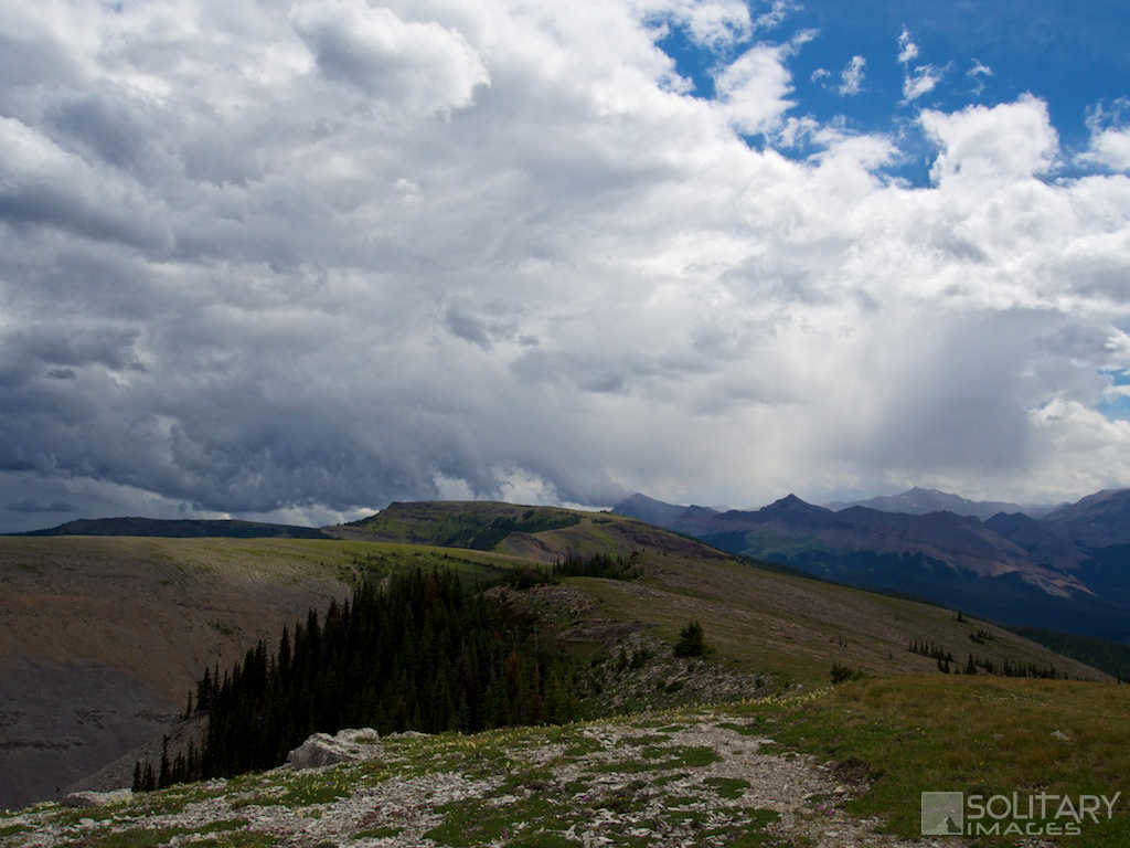
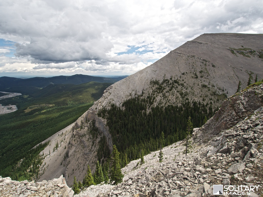
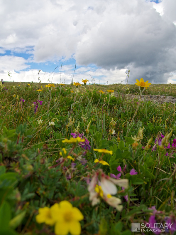
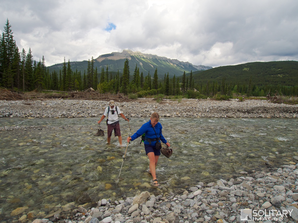
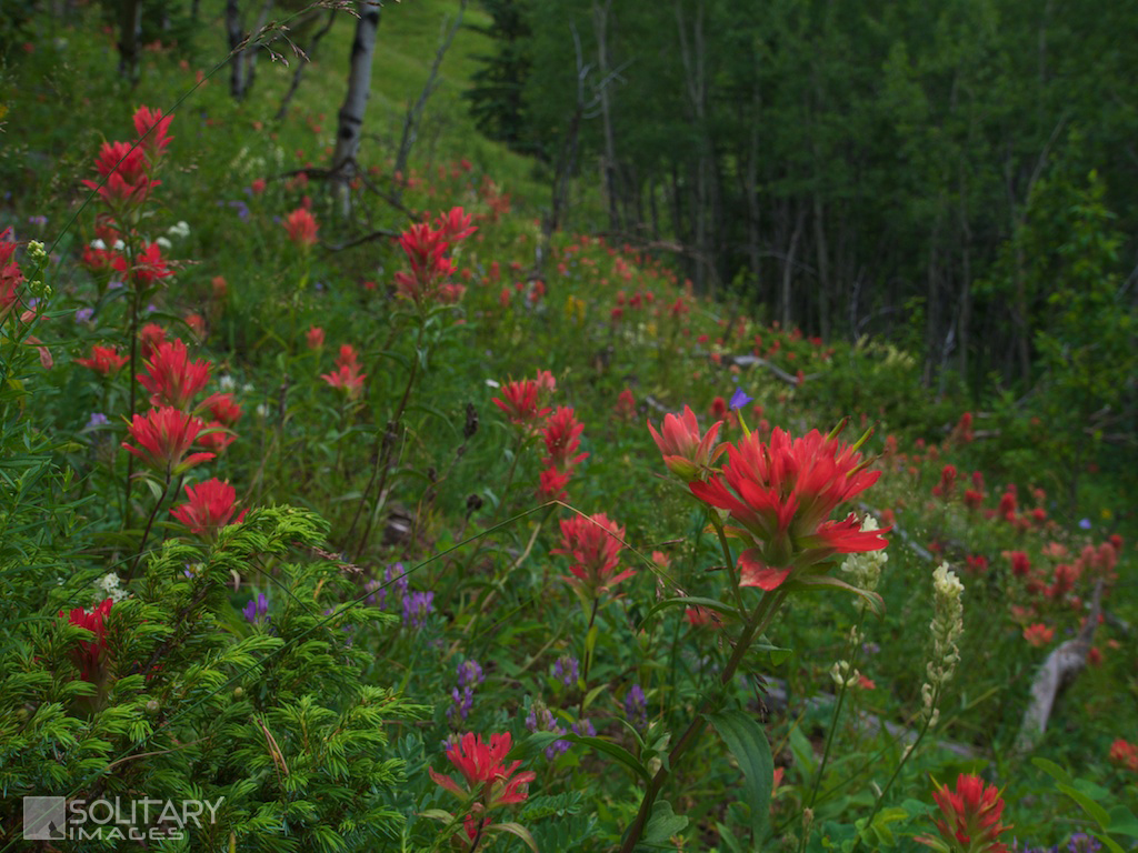
One of the most expansive alpine meadows in the valley, loaded with flowers, mountain views, foothill views, prairie views and distant city views! A quick climb plants you on an a wide open ridge providing lots of Alpine wandering. The short route (Forgetmenot Ridge), ends at a giant cairn that appears to be perched on the edge of the world. The long route (Forgetmenot Mtn) involves a meandering alpine wander to Forgetmenot's summit proper. Both routes involve a river crossing. Sandles are worth more than their weight in gold, for this short ford.
Forgetmenot Ridge
Distance: 12.5 km return Elevation Gain: 628 m Total Elevation Gain: 700 m Physical Difficulty: 3/5 Technical Difficulty: 2/5 Time: 4-6 hrs Forgetmenot Mountain Distance: 21.1 km return Elevation Gain: 704 m Total Elevation Gain: 1127 m Physical Difficulty: 4/5 Technical Difficulty: 2/5 Time: 6 - 8 hrs 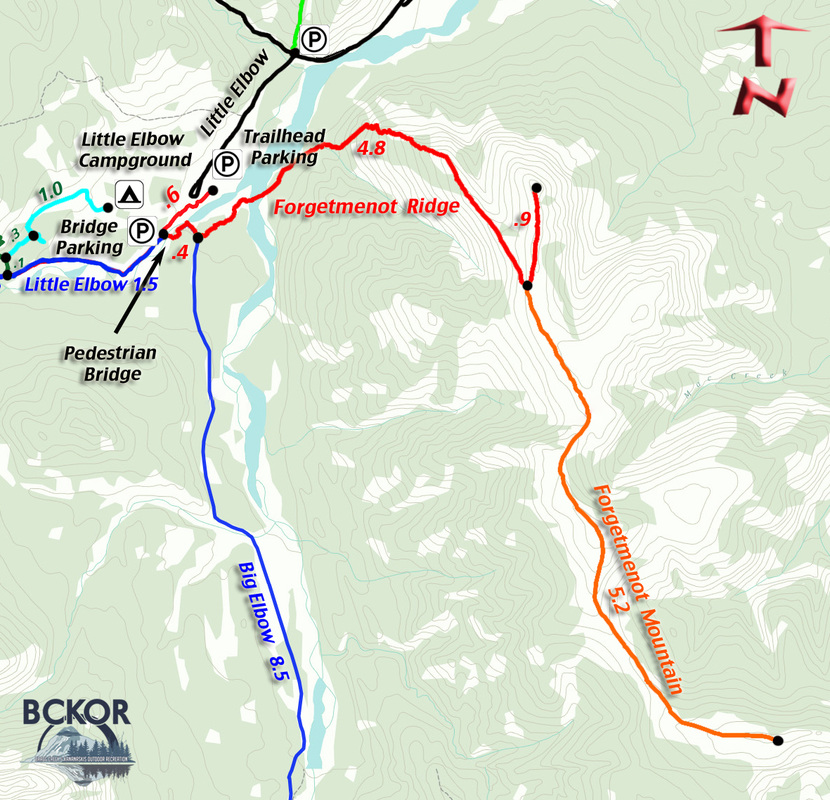

Forgetmenot Ridge Profile

Forgetmenot Mountain Profile
|
To Get Here: From the 4 way stop on HWY 22 next to Bragg Creek, take HWY 22 south to a T intersection. Turn right (westbound) on HWY 66. Travel 27.5 km to the intersection of Hwy 66 and Powderface Road. Turn left towards Little Elbow Campground and park in the trail head parking on your first left past Forgetmenot pond.
This section of HWY 66 is closed between Dec 1 to May 14 Trail Description:
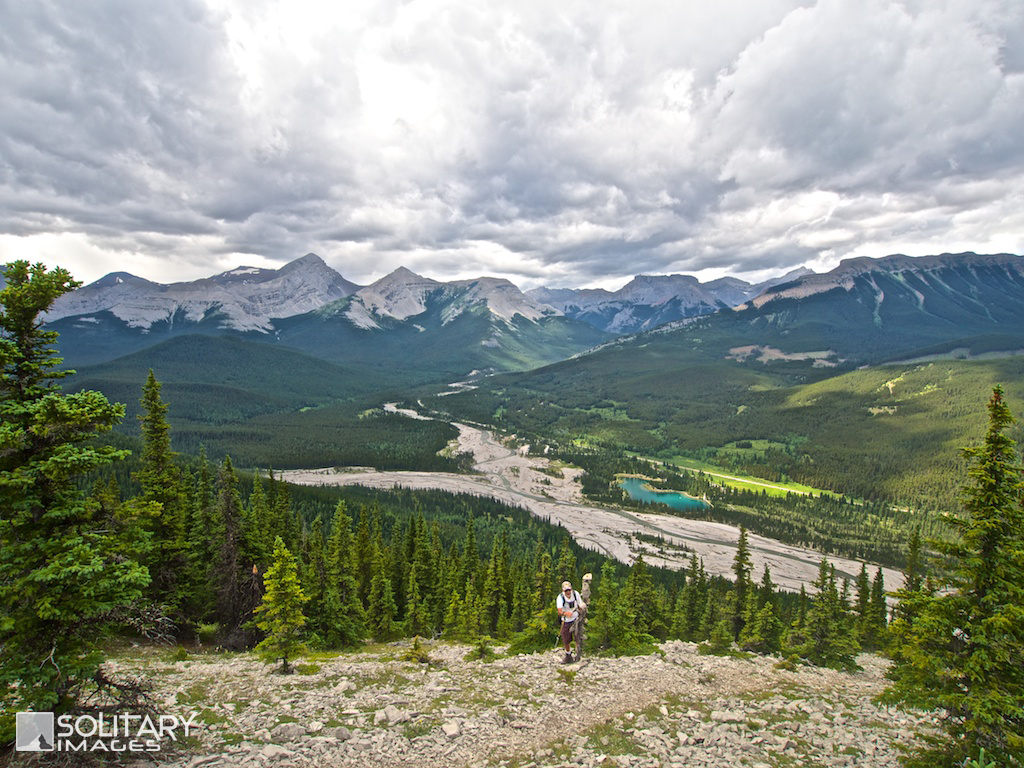
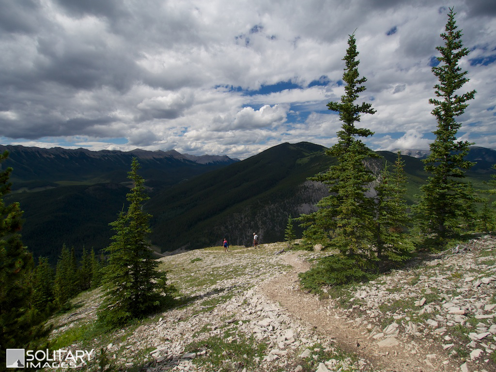
From the parking lot, start SW along side Little Elbow River on Little Elbow Trail for 600m. This trail meanders alongside the Little Elbow River, however the flood of 2013 has washed out some portions and you will need to make your way up the bank onto the roadside for a portion of it. Take the swinging pedestrian bridge across the river and follow the trail to the left. There is alternative parking at the bridge but it is often full. Continue for 450m past the bridge on the Big Elbow Trail, to the signed trail intersection of Big Elbow Trail, Little Elbow Trail and Wildhorse Trail. Turn left on the Wildhorse Trail and backtrack NE alongside Little Elbow River until you reach the expansive gravel flats of the Elbow River. Continue across the flats and cross the Elbow River. Despite the name, Little Elbow River generally holds more water than Elbow River. However, caution must be used especially in the spring, when fast cold water can create a major hazard. Upon crossing, rejoin the trail near the confluence of Little Elbow and Elbow Rivers. The trail continues to wander alongside the Elbow River for 1.6km until it crosses a small creek bed in the valley SW of Forgetmenot Ridge. Immediately after crossing the creek bed, a small single track trail veers right and begins to climb steeply up Forgetmenot Ridge. This is the obvious crux of the hike as it continues a sharp ascent for 1.5km up the rocky ridge, The views over Forgetmenot Pond and Powderface Ridge will help you ignore the calf burn and continue on. The trail tops out and continues to wander SE along the ridge top slowly making it's way around and up onto the true Foregetmenot Ridge. Make a sharp turn to the left and wander North for 900m to the Ridge summit and a massive cairn overlooking the entire valley. If you feel the desire to extend the amazing ridge top walkabout, you can ignore the north turn and continue south for 5.2km along the wide ridge crest to the actual Forgetmenot Mountain summit. This option adds a total of 10.4km and 483m total elevation gain.
| ||||||||||
Return to Bragg Creek Area Hiking/Running Trails (click here)
Return to Hiking/Running Trails (click here)
Return to Hiking/Running Trails (click here)