Canmore Area
Scenic spots with easy access make this area popular. With the world famous Bow River being fed from numerous mountain lakes, this is the center of fishing in the area
Any fishing requires a license as well as adhering to specific rules and regulations for each body of water. Please visit Alberta Guide to Sportfishing Regulations for more info.
Any fishing requires a license as well as adhering to specific rules and regulations for each body of water. Please visit Alberta Guide to Sportfishing Regulations for more info.
Gap Lake

Another easy access favorite for Canmore locals. A small lake next to the 1a HWY makes for a great easy afternoon float. Bring a rod and test your luck with a variety of fish looking for food below.
|
To Get Here: From the east end of Canmore, take Hwy 1a east for 8km to Gap Lake on your right. Alternate access is available from the east down Hwy 1a. Click on "View Larger Map" on the bottom, to access a full size interactive map that can provide directions from your current location. |
Quarry Pond
A small pond located on the hillside above Canmore. This area is very popular for dog walking, swimming, running and biking so watch your back casts. A relaxing spot close enough to snag a fish on your lunch break, if you live in Canmore.
|
To Get Here: From Canmore take Spray Lakes Road towards the Canmore Nordic Centre. Quarry Lake is just prior to the Nordic Centre on the left hand side. Click on "View Larger Map" on the bottom, to access a full size interactive map that can provide directions from your current location. |
Bow River
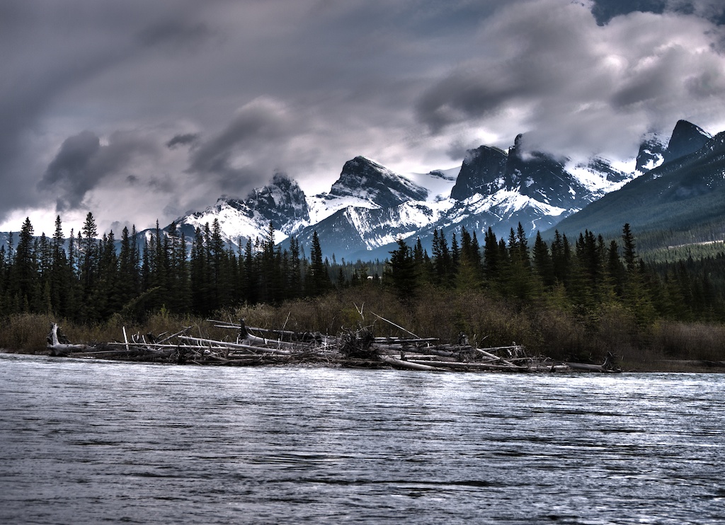
A large river boasting a world famous Trout habitat. You'll find numerous species, mainly Brown Trout, a few Bull, Brook, Cutthroat and Lake Trout and lots of Mountain Whitefish. Concentrate on the small side streams for Brook Trout and west of Canmore for Cutthroat. A solitary experience, the Upper Bow is almost poetic with the cliffs rising around a river teaming with wildlife. Look for eddies, log jams, pools and undercut banks. A great river to drop the canoe into and spend the day fishing and floating for more info on canoeing the bow, visit Favorite Rivers
|
To Get Here: The river runs between the Trans Canada HWY 1 and HWY 1A. There are several areas where you can access the river through day sites, campgrounds and bridges. The river runs through First Nations land between Canmore and the Ghost Resevoir. Ensure that you are either outside the reservation, or obtain permission from the Morley band office before exploring this area. Click on "View Larger Map" on the bottom, to access a full size interactive map that can provide directions from your current location. |