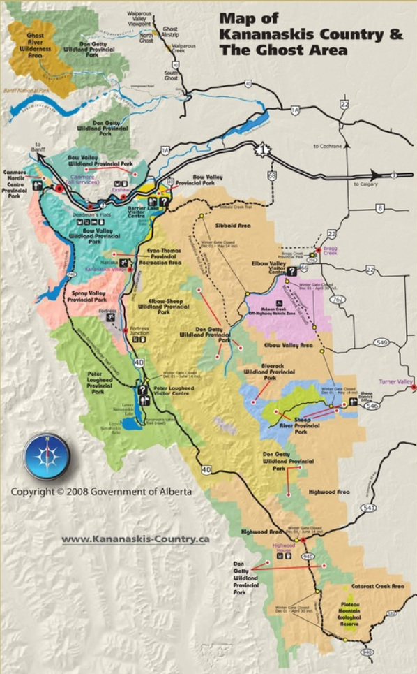
Overview of the Kananaskis & Bragg Creek Area
_Map(s) produced by Kananaskis Region | Parks Division | Tourism, Parks and Recreation Ministry, Government of Alberta
| Click to Download Map |
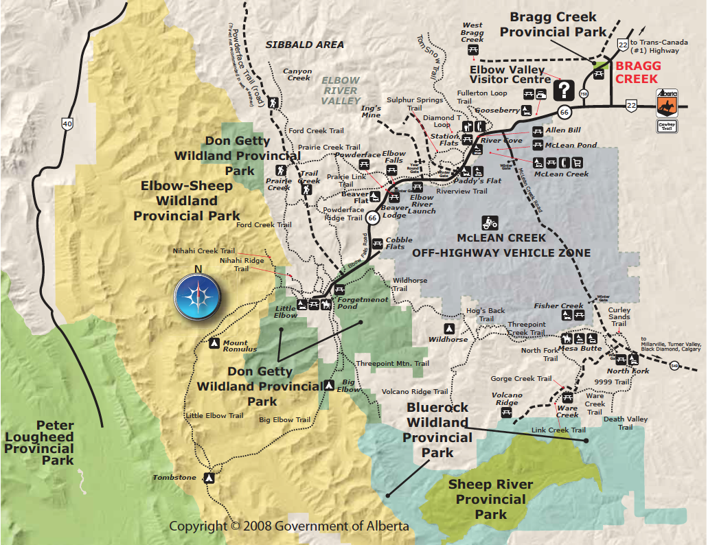
Elbow River Valley
_Map(s) produced by Kananaskis Region | Parks Division | Tourism, Parks and Recreation Ministry, Government of Alberta
| Click to Download Map |
Spray Valley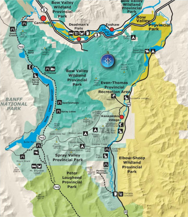
|
Kananaskis Valley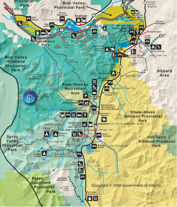
|
Map(s) produced by Kananaskis Region | Parks Division | Tourism, Parks and Recreation Ministry, Government of Alberta
|
| ||||
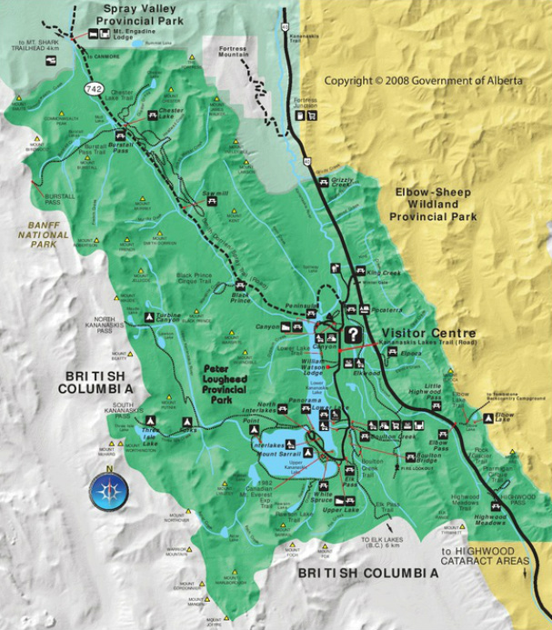
Peter Lougheed Provincial Park
_Map(s) produced by Kananaskis Region | Parks Division | Tourism, Parks and Recreation Ministry, Government of Alberta
| Click to Download Map |
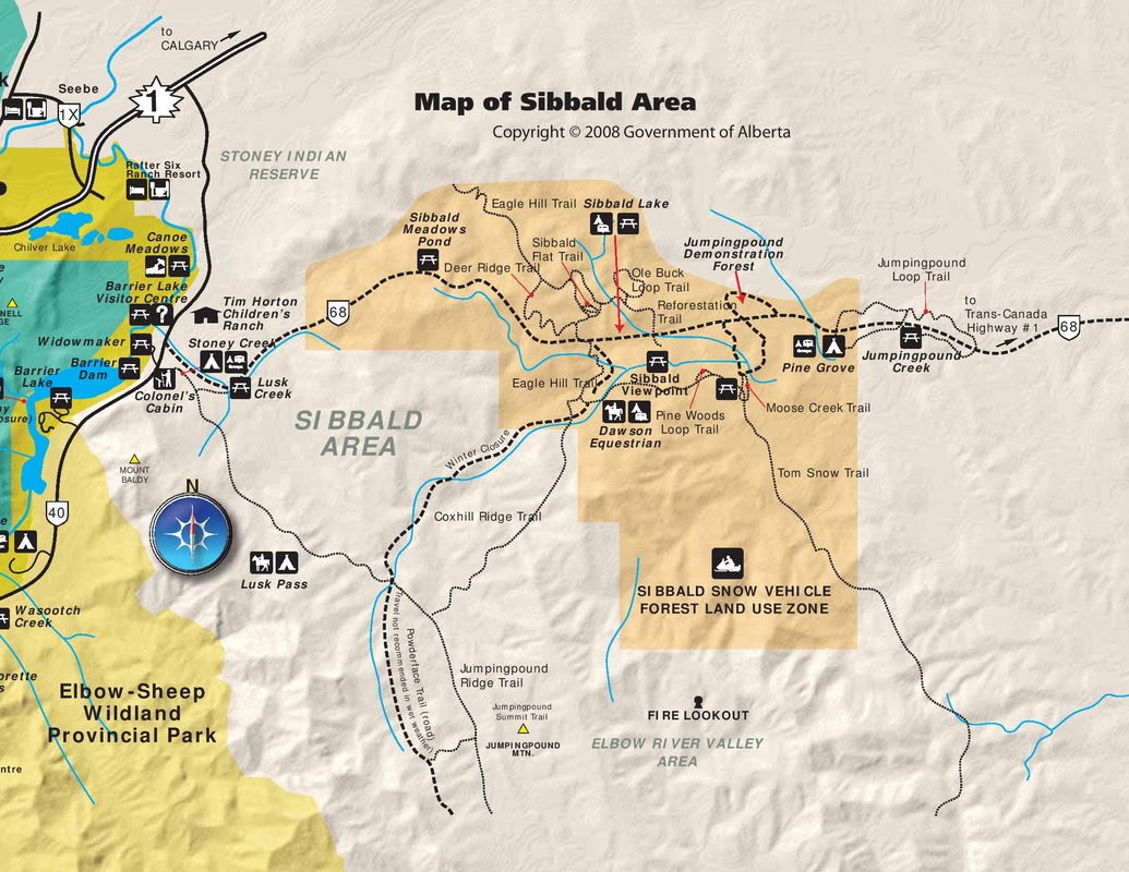
Sibbald Area
_Map(s) produced by Kananaskis Region | Parks Division | Tourism, Parks and Recreation Ministry, Government of Alberta
| Click to Download Map |
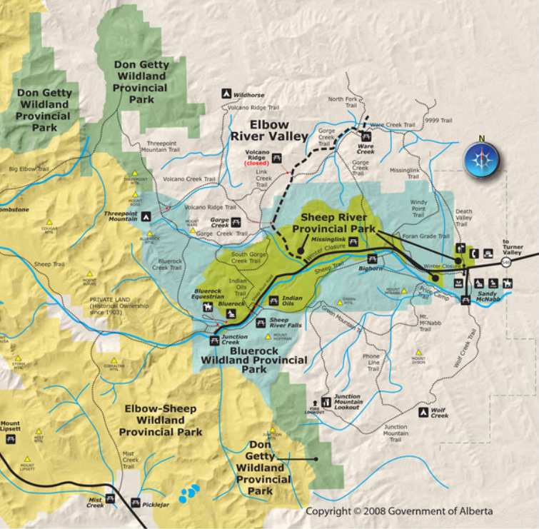
Sheep River Valley
_Map(s) produced by Kananaskis Region | Parks Division | Tourism, Parks and Recreation Ministry, Government of Alberta
| Click to Download Map |
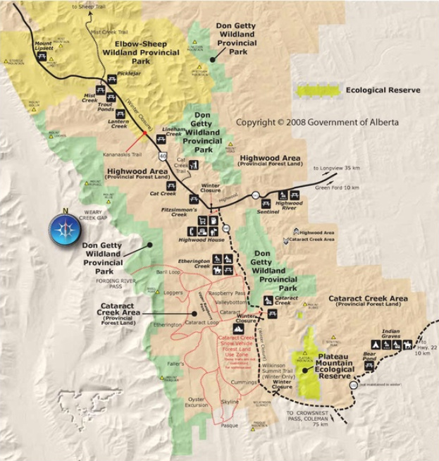
Highwood & Cataract Creek Areas
_Map(s) produced by Kananaskis Region | Parks Division | Tourism, Parks and Recreation Ministry, Government of Alberta
| Click to Download Map |
Bragg Creek and Sheep Valley - Kananaskis Country
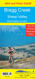
This map covers the popular recreational terrain close to Calgary, from Sibbald Flats (Hwy 68) in the north, through the Elbow Valley (Hwy 66), and south to Hwy 546 in the Sheep Valley. The map extends west as far as Powderface Trail Road.
Popular hiking and biking trails covered on this map include Elbow Falls, Prairie Mountain, Fullerton Loop, Moose Mountain, Sulphur Springs, Nihahi Ridge, Powderface Ridge, Jumpingpound Ridge, Cox Hill, Sheep River Falls, Volcano Ridge, Ole Buck Loop and Deer Ridge.
Also on the back of the map are trail descriptions and photos of 20 highly recommended day hikes, seven classic mountain bike rides, as well as one prime area recommended for cross-country skiing. Also on the back is contact information for visitor centres and campgrounds.
Kananaskis Lakes
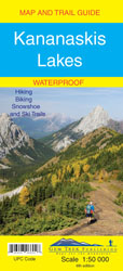
This map covers what some say is the most scenic terrain in all of Kananaskis Country - the upper Smith-Dorrien-Spray Trail south of Mt. Shark, Peter Lougheed Provincial Park including the network of trails in the Kananaskis Lakes area, and the northern part of Elk Lakes Provincial Park.
Popular day hikes covered on this map include Elbow Lake, Chester Lake, Burstall Pass, Headwall Lakes, Kananaskis Lookout, Upper Kananaskis Lake Circuit, Rawson Lake, Elk Lakes and Ptarmigan Cirque where more than 80 species of wildflowers have been identified by budding botanists.
On the back of the map are trail descriptions and photos of 16 recommended day hikes, three overnight trips and nine classic mountain bike rides, as well as six recommended trails for novice and intermediate snowshoers and two areas recommended for cross-country skiing. Also on the back is a 1:25 000-scale inset map of the immediate Kananaskis Lakes area, as well as contact information for visitor centres, campgrounds, hotels and lodges.
Canmore and Kananaskis Village
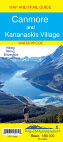
This map covers some of the most popular terrain for hikers and mountain bikers in Kananaskis Country - Bow Valley Provincial Park, the Canmore area, the Smith-Dorrien/Spray Lakes area south to Mount Shark trailhead, Barrier Lake, and the Kananaskis Village area from Ribbon Creek south to Galatea Lakes trailhead.
Other classic trails covered on this map include Grassi Lakes, Yamnuska, Ha Ling, Lady Macdonald, Barrier Lake Lookout, Mt. Allen via Centennial Ridge (the highest maintained trail in the Canadian Rockies), Ribbon Falls and Ribbon Lake, Lillian and Galatea lakes, Karst Spring and Buller Pass.
On the back of the map are trail descriptions and photos of 14 highly recommended day hikes, three overnight trips and eight classic mountain bike rides, as well as three areas recommended for cross-country skiing. Also on the back is a 1:25 000-scale inset map of the Kananaskis Village-Ribbon Creek area, as well as contact information for visitor centres, campgrounds, hotels and lodges.
Highwood & Cataract Creek - South Kananaskis Country
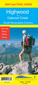
This is the fourth map in Gem Trek's Kananaskis Country series, covering south Kananaskis Country from Sheep River Falls in the north to Plateau Mountain in the south. It extends coverage south where the Bragg Creek-Sheep Valley map leaves off, and east where the Kananaskis Lakes map leaves off. It covers the trails southeast of Highwood Pass and accessed by Highways 40, 541, 940 and 542 (Johnson Creek Trail).
Popular trails on this map include Sheep River Trail, Junction Fire Lookout, Picklejar Lakes, Mt. Lipsett, Mist Ridge, Zephyr Creek, Grass Pass, Bull Creek Hills, Mt. Burke and Raspberry Ridge.
Also on the back of the map are trail descriptions and photos of 18 recommended day hikes, two overnight trips and three classic mountain bike rides, plus contact information for visitor centres, campgrounds, hotels and lodges.
go to BCKOR Home (click here)