Sheep River Picnic Sites
Gorge Creek Trail (Road)
A great place to get away from it all. This road is a perfect detour to ditch the crowds and drive through some peaceful wilderness. Frequent meadows and pull offs alongside Ware Creek, provide countless picnic opportunities. A great escape from the hectic day to day stresses. Although a four wheel drive isn't normally required, this road can be fairly rough at times.
|
To Get Here: From Millarville, take HWY 549 for 16.8km to Gorge Creek Trail on your left just past North Fork Campground. Follow this road for 7.6km to Ware Creek parking lot at the end. Click on "View Larger Map" on the bottom, to access a full size interactive map that can provide directions from your current location. |
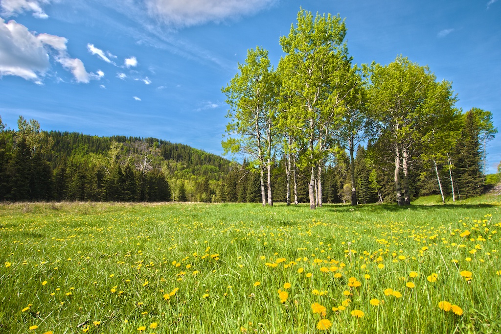
Ware Creek
A peaceful spot far away from the crowds at the end of Gorge Creek Trail. From here you can intercept a number of hiking and equestrian trails or just enjoy the peaceful creek and surrounding meadows.
|
To Get Here: From Millarville, take HWY 549 for 16.8km to Gorge Creek Trail on your left just past North Fork Campground. Follow this road for 7.6km to the end. Click on "View Larger Map" on the bottom, to access a full size interactive map that can provide directions from your current location. |
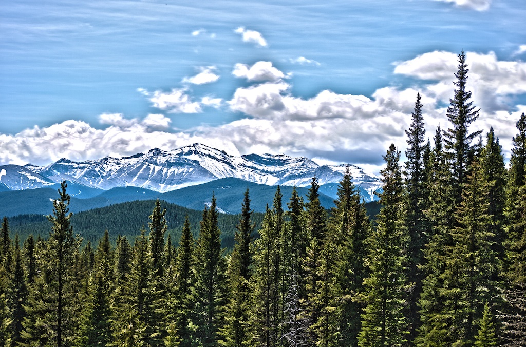
HWY 546
A beautiful highway winding through the unique forested areas, grasslands loaded with wildflowers, wildlife, and rock outcroppings. Centered around the lifeline of the mesmerizing Sheep River, deep in the valley below.
|
To Get Here: From the 4-way stop in Turner Valley on Highway 22, take HWY 546 Westbound into the Sheep River Valley. Click on "View Larger Map" on the bottom, to access a full size interactive map that can provide directions from your current location. |
Bighorn
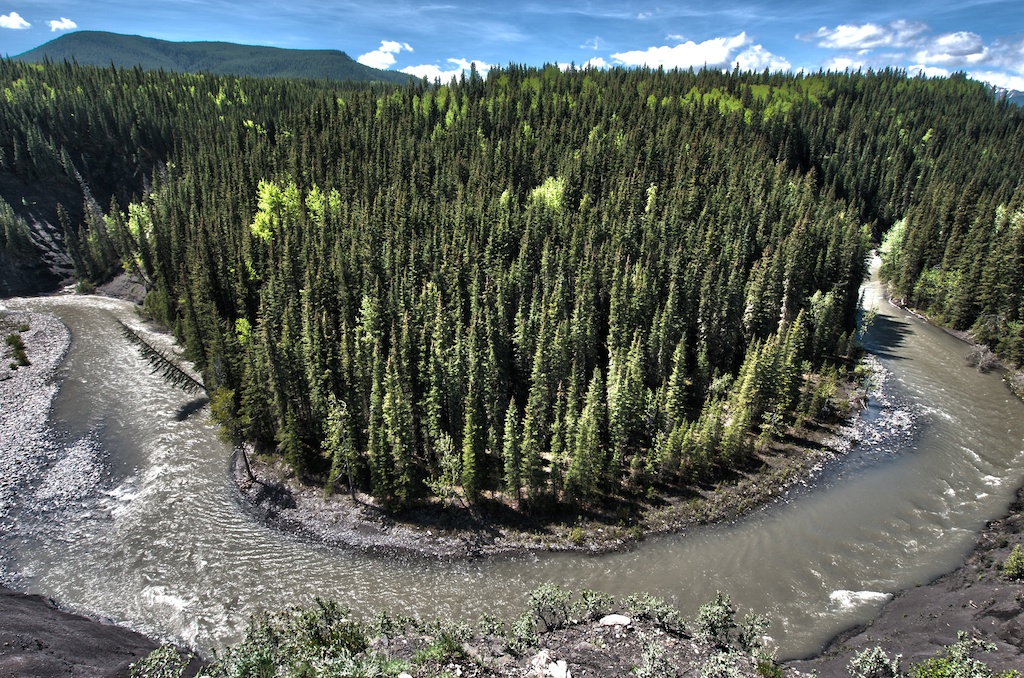
A tranquil spot next to the highway overlooking a deep section of the Sheep River, walled by dark black banks. A south facing slope is loaded with flowers and the river makes a unique horseshoe turn deep below. Use caution as you approach the overlook, as the river is constantly eroding the bank and the bank may be unstable.
|
To Get Here: From Turner Valley, take HWY 546 West for 23.5km to the Bighorn parking lot on your left. The flowering hillside and horseshoe river overlook is a steep short walk down the slope from the parking lot. Click on "View Larger Map" on the bottom, to access a full size interactive map that can provide directions from your current location. |
Gorge Creek
Located at the end of the road that once connected Ware Creek to Gorge Creek. Gorge Creek doesn't provide a very good picnic spot at the parking lot but it does give you access to a large trail network that has countless picnic areas with amazing views throughout.
|
To Get Here: From Turner Valley, take HWY 546 West for 29.5km to TWP 195B Road on your right. Follow this road for another 5.3km to the end of the road and Gorge Creek parking lot on your left. Click on "View Larger Map" on the bottom, to access a full size interactive map that can provide directions from your current location. |
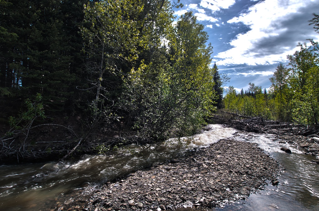
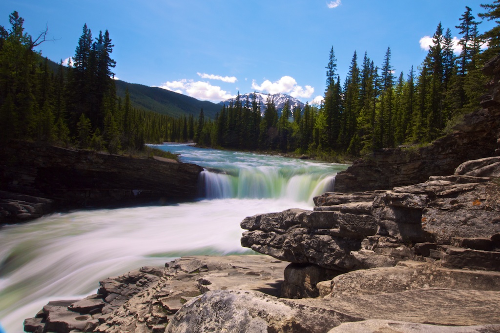
Indian Oils
From the back end of the parking lot follow a short trail/road to a beautiful turbulent section of the Sheep River. Short drops and unique rock formations pushes the river to bounce and jumble through a maze of rocks.
|
To Get Here: From Turner Valley, take HWY 546 West for 34.3km to Sheep River Falls parking lot on your left. The Falls are a short walk along the river, from the parking lot. Click on "View Larger Map" on the bottom, to access a full size interactive map that can provide directions from your current location. |
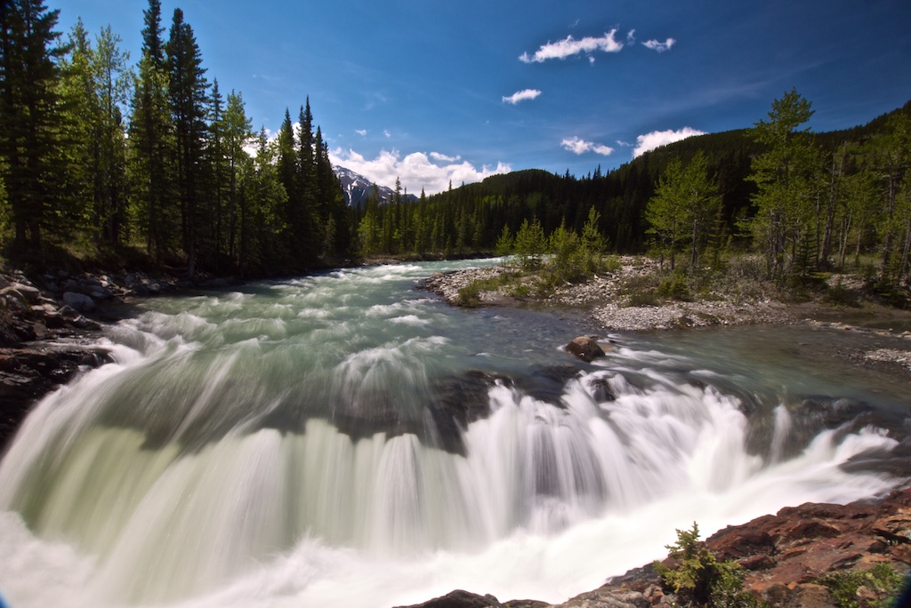
Sheep River Falls
The unknown sister to Elbow Falls. A serene two step drop with a unique rock outcropping provides the ultimate picnic area void of large crowds. A local favorite with easy access and picnic tables nearby.
|
To Get Here: From Turner Valley, take HWY 546 West for 35.5km to Sheep River Falls parking lot on your left. The Falls are a short walk along the river, from the parking lot. Click on "View Larger Map" on the bottom, to access a full size interactive map that can provide directions from your current location. |
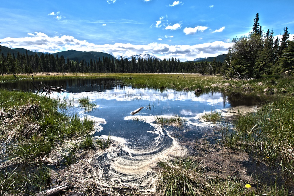
Junction Creek
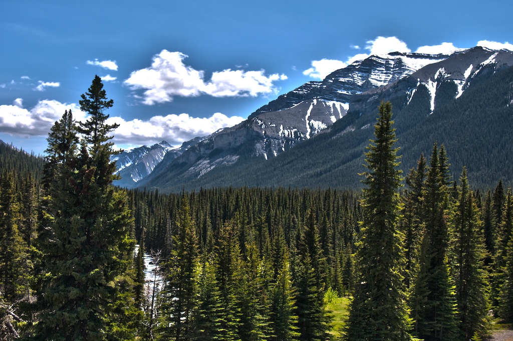
The end of the Sheep River Road, doesn't disappoint. The valley splits into three paths, each containing a beautiful mountain stream with mountains rising behind. From here a variety of trails take off into the mountain backdrop.
|
To Get Here: From Turner Valley take HWY 546 West for 37km until you reach Junction Creek at the end of the road. Click on "View Larger Map" on the bottom, to access a full size interactive map that can provide directions from your current location. |