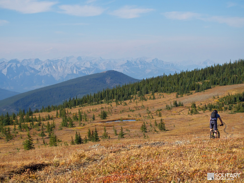
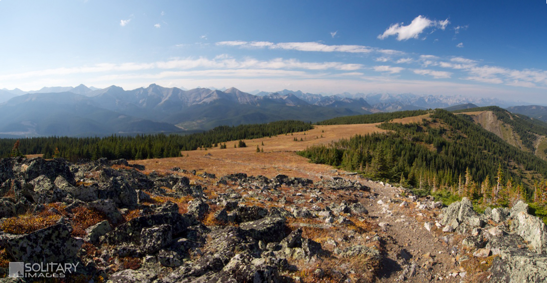
The ultimate Kananaskis adventure trail with non-stop rugged mountain views, enjoyed from a never ending ridge top in a remote setting. Fast flow single-track through alpine meadows, interspersed with gnarly technical climbs and descents deep in the wilderness, away from the crowds. Trails can be rode as loops or 1-way shuttles when Powderface Trail is open.
|
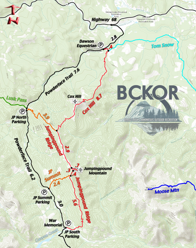
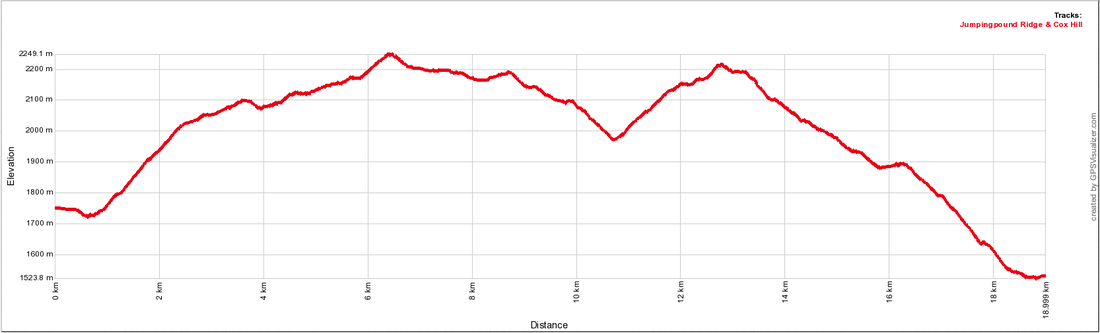
Jumpingpound Ridge
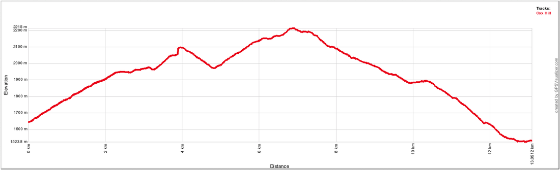
Cox Hill
|
To Get Here: (When Powderface Trail is open) From the 4 way stop on HWY 22 next to Bragg Creek, take HWY 22 south to a T intersection. Turn right (westbound) on HWY 66. Travel 27.3 km west down HWY 66 to Powderface Trail. Take Powderface Trail North for 32 km to Dawson Equestrian.
(When Powderface Trail is closed) Take HWY 22 North to HWY 1. Turn West and Take HWY 1 to HWY 68. Take HWY 68 south west for 23km to the Powderface Trail turnoff. Take Powderface Trail south for 2.7km to Dawson Equestrian Campground just before the winter gates. Trail Description(s)
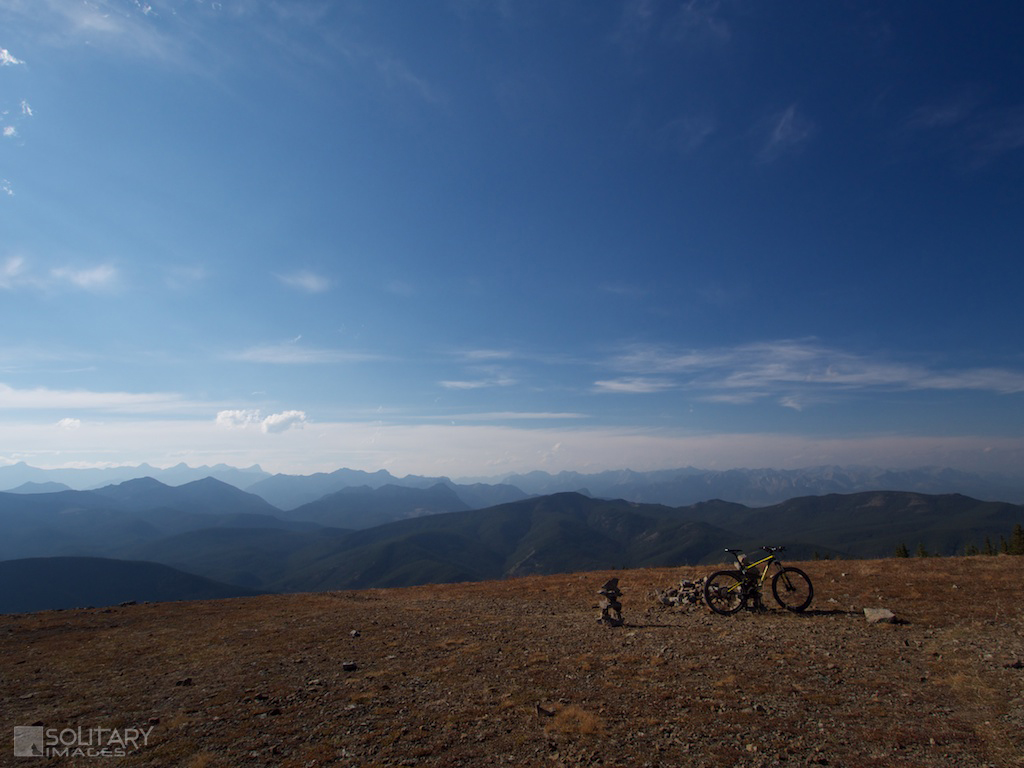
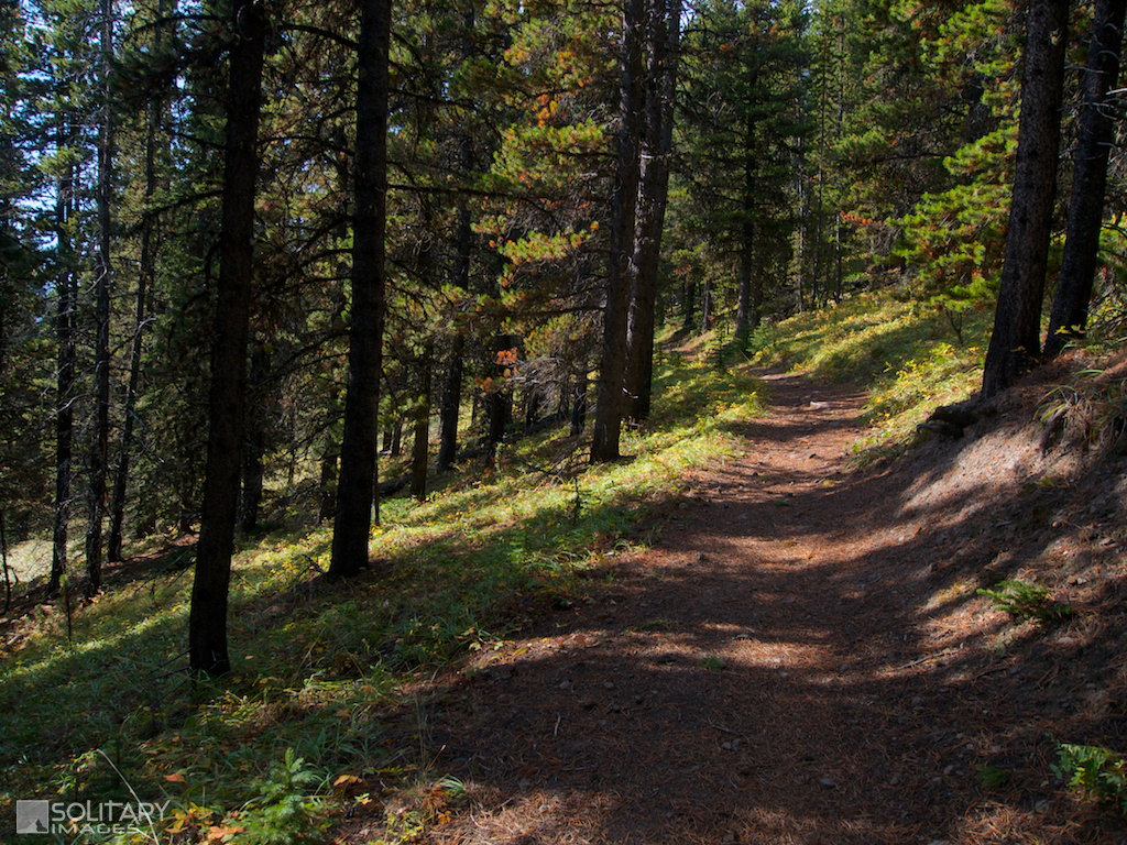
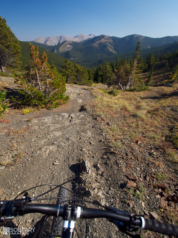
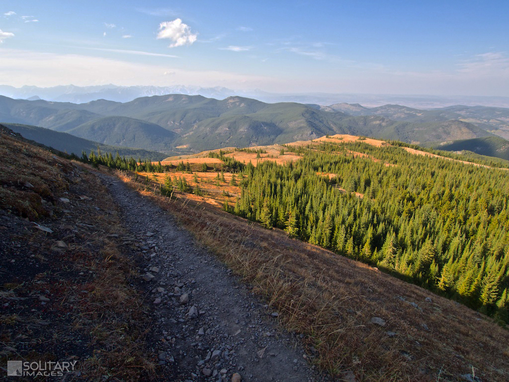
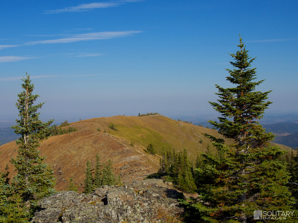
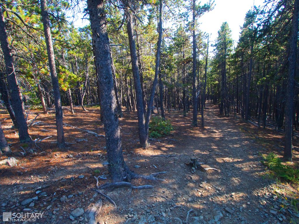
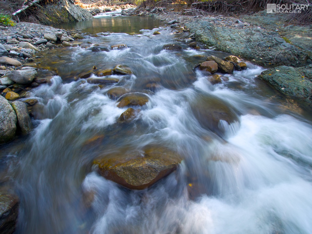
Jumpingpound Ridge & Cox Hill: From Dawson Equestrian campground ride or shuttle south on Powderface Trail for 17.1km to a parking area located across from the War Memorial just North of Canyon Creek. Ride alongside Canyon Creek for 1.4km to the Jumpingpound Ridge trail turnoff. Turn left and begin a steep technical climb up the shoulder for 2km before the angle eases and continues to climb to the summit of Jumpingpound Mountain. Making the short detour to the summit is well worth the energy and provides a great break spot before beginning your first descent. From the summit, the trail descends for 4km through alpine meadows and trees. Keep right at the Cox Hill junction and enjoy the descent before a 2km grind back up to the summit of Cox Hill. From Cox Hill, the trail drops steeply from the ridge through the trees for 6km until hitting the valley bottom. Keep left at the Tom Snow juction and cross the creek to Dawson Equestrian parking. Cox Hill: From Dawson Equestrian ride or shuttle for 7.7km south on Powderface Trail to the north JP Ridge trailhead. Take the JP Ridge and Cox Hill trails back to Dawson Equestrian. Jumpingpound Ridge: Park at the north JP Ridge trailhead, across from Lusk Pass, 7.7km south of Dawson Equestrian. Shuttle or ride for another 9.3km to the south Jumpingpound Ridge trailhead across from the War Memorial. Ride JP Ridge for the full length keeping left at the Cox Hill junction to return to JP north parking. Jumpingpound Summit (short): Park at the north JP Ridge trailhead, across from Lusk Pass, 7.7km south of Dawson Equestrian. Shuttle or ride for another 6.2km south to the JP Summit trailhead. Take the JP Summit and JP ridge trails back to JP north parking. |

Cox Hill
GPX Files:
|
Jumpingpound Ridge & Cox Hill
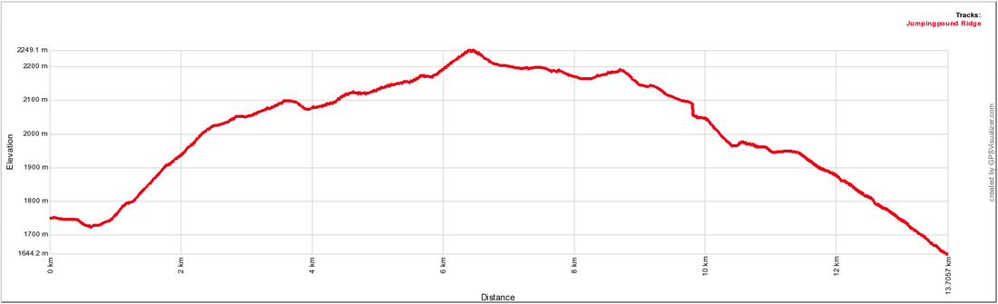
Jumpingpound Ridge
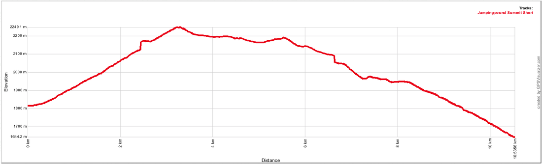
Jumpingpound Summit (Short)
| ||||||||