Bragg Creek & Kananaskis Outdoor Recreation
  • Home
    • About Us
    • Contact Us
    • Terms of Use
    • Bragg Creek Hamlet >
      • Bragg Creek & Kananaskis History
  • Christmas Trees
  • Film Fest in Bragg Creek!
  • Events
  • Camp
  • Bike
    • Mountain Biking >
      • MTB Trails
      • MTB Groups
      • MTB Races
      • MTB Guidebooks
      • MTB Trail Etiquette
    • Cycling >
      • Favorite Road Rides
      • Cycling Groups
      • Cycling Races
  • Hike/Run
    • Hiking/Running Trails
    • Hiking >
      • Hiking Groups
      • Hiking Events
      • Hiking Guidebooks
    • Trail Running >
      • Trail Running Groups
      • Trail Running Races
      • Trail Running Guidebooks
  • Ski
    • Nordic/Snowshoe >
      • Nordic & Snowshoe Areas
      • Nordic & Snowshoe Groups
      • Nordic & Snowshoe Races
      • Nordic & Snowshoe Guidebooks
    • Backcountry Skiing >
      • Backcountry Skiing Areas
      • Backcountry Skiing Groups
      • Backcountry Skiing Guidebooks
  • Climb
    • Rock Climbing >
      • Popular Climbing Areas
      • Climbing Guidebooks
    • Alpine Climbing >
      • Popular Alpine Climbs
      • Alpine Climbing Guidebooks
    • Ice Climbing >
      • Ice Climbing Guidebooks
    • Climbing Groups
  • Paddle
    • Favorite Lakes
    • Favorite Rivers
    • Paddling Groups
    • Paddling Events
    • Paddling Guidebooks
  • Fish
    • Fishing Areas
    • Fishing Guidebooks
    • Fishing Groups
  • Picnic
    • Bragg Creek Area
    • Canmore Area
    • Central Kananaskis Area
    • Highwood Area
    • Peter Lougheed Area
    • Sheep River Area
    • Sibbald Area
  • Equestrian
    • Favorite Equestrian Areas
    • Equestrian Groups
    • Equestrian Events
    • Equestrian Guidebooks
  • Caving
    • Caving Areas
    • Caving Groups
    • Caving Guidebooks
  • Off-Highway Vehicles
    • Favorite OHV Areas
    • OHV Groups
    • OHV Races
  • Snowmobile
    • Favorite Snowmobile Areas
    • Snowmobile Groups
  • Logging Kananaskis!
    • Structure Retention Directive
    • Current Logging Plans
    • Logging vs. Recreation
    • How to Help!
  • Maps
  • Photos
  • Link Page

Ultimate Link-up: Moose Mountain to West Bragg Creek

The Ultimate Link-up allowing you to experience everything from summiting a mountain, a steep downhill adrenaline rush, and finishing off on some valley bottom single track, weaving alongside scenic riversides. Starting at the top of Moose Mountain road allows you to prolong your day without completely destroying your legs.

Picture
Picture
Picture
Style: Cross-country
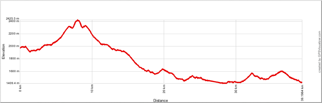
Distance: 39.2km
Elevation Gain: 445m
Total Elevation Gain: 1239m
Elevation Loss: 553m
Total Elevation Loss: 1793m
Physical Difficulty: 4/5
Technical Difficulty: 3/5
Time: 5.5 - 8 hours
Picture
Picture
Picture
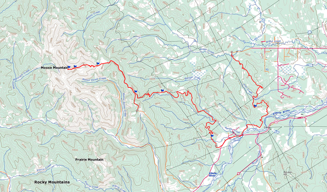
To Get Here: From the 4 way stop on HWY 22 next to Bragg Creek, take HWY 22 south to a T intersection. Turn right (westbound) on HWY 66. Travel 16.1km west down HWY 66 to Moose Mountain Road on your first right past Station Flats. Take this dirt road to the the last corner before the end, where you'll find the Moose Mountain Summit parking lot on your right. 
Trail Description:

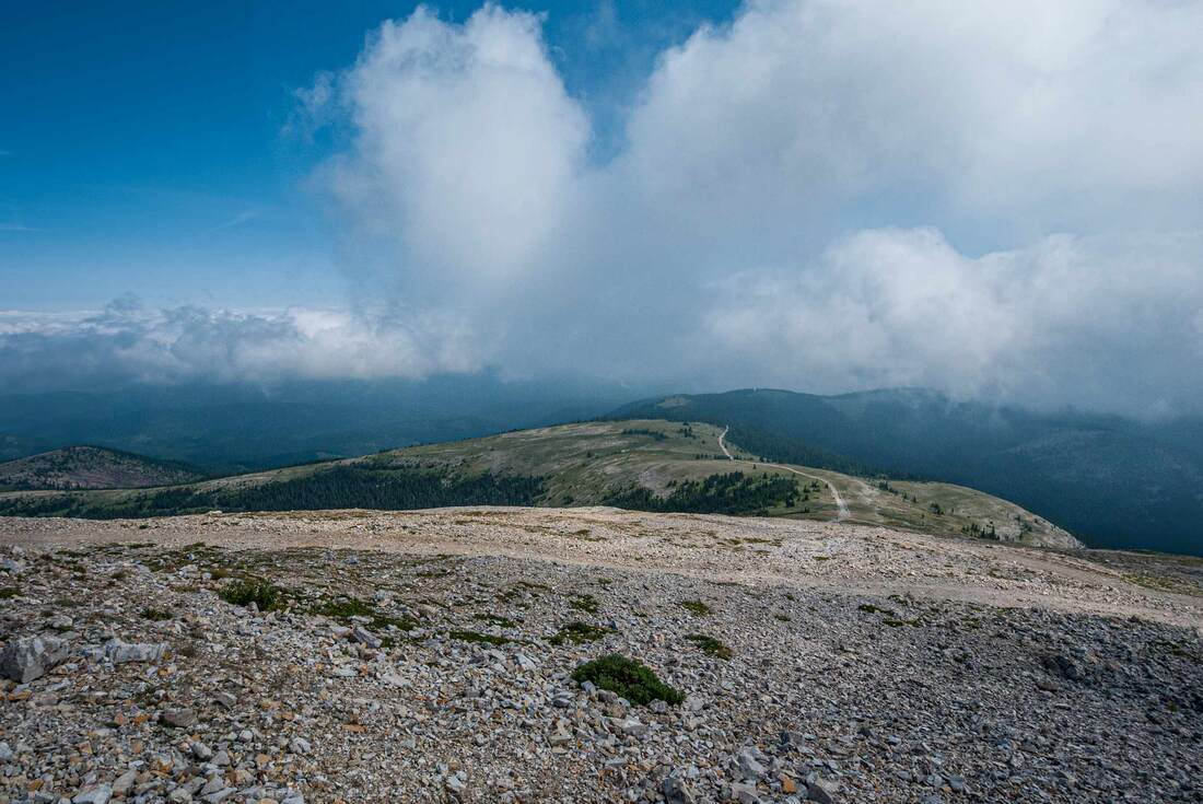
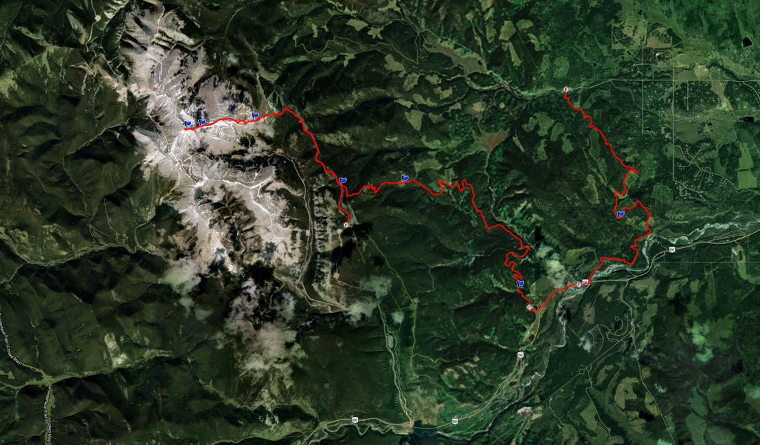
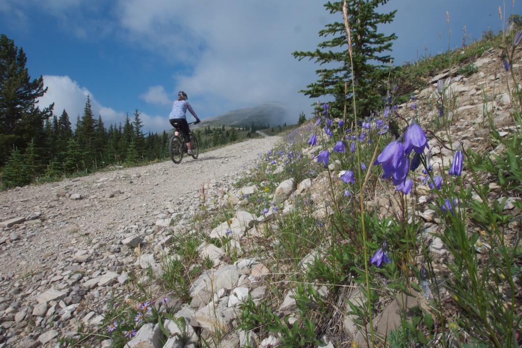
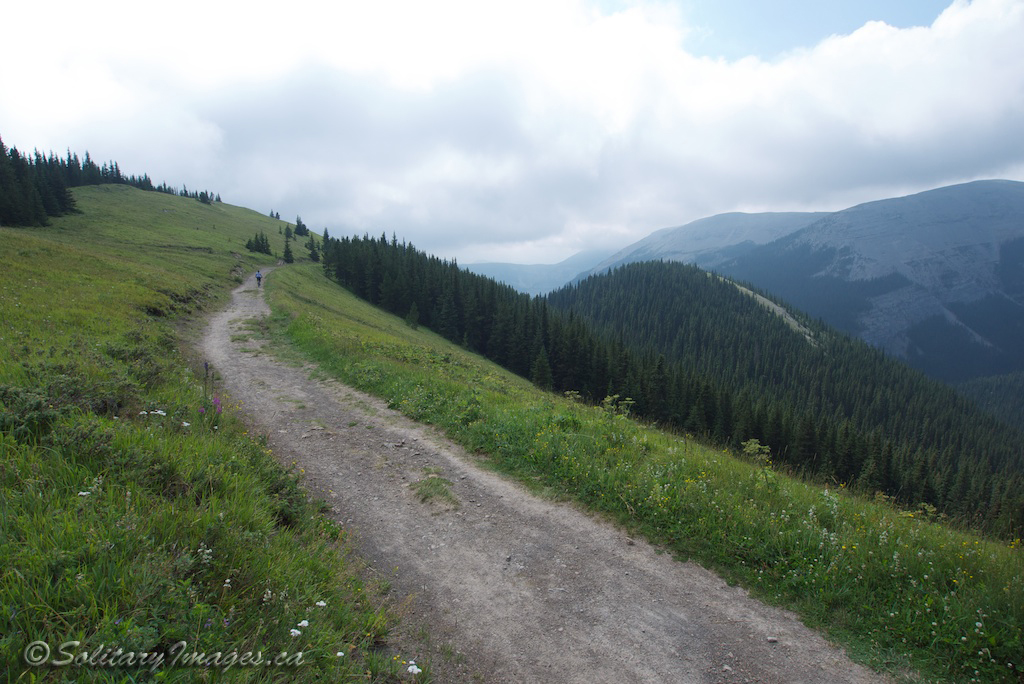
From the Moose Mountain summit parking lot, bike a few meters back towards HWY 66 to gain a narrow road with an access gate. Follow this road as it descends for 80m and just over 1km to the Moose Packers junction. Stay left and follow the road as it begins the long 500m climb back up towards the summit. At 7.5km bikes are prohibited. Scramble to the summit before turning around and point it back down to the Moose Packer's trail head. Start the adrenaline descent down the Moose Packers single track before exiting at the top of Rideback. Ridgeback continues the descent through tight pine trees dispersed with the odd meadow and poplar patch. A few short climbs keep the quality descent going right to the Station Flats parking lot. Exit the parking lot and ride the road a short distance to Allan Bill Parking lot. The start of Elbow trail is on the opposite side of the highway from Allan Bill Parking and parallels the highway to the east. Snagmore takes off to the right after a short climb along Elbow Trail. Continue climbing alongside the Elbow River and over the ridge before dropping down into the Iron Creek Valley. Climb back up on Boundary Ridge trail to the final descent down to West Bragg Creek Parking.


Moose Mountain to West Bragg Creek.gpx
File Size: 419 kb
File Type: gpx
Download File


go to Moose Mtn Area MTB Trails (click here)
go to Bragg Creek Area MTB Trails (click here)
go to Mountain Bike Trails (click here)

Follow @BCKOR

Contact
Terms of Use
Copyright ©  2013-2014 Bragg Creek & Kananaskis Outdoor Recreation (BCKOR Ltd.) All Rights Reserved.