Mount King George
A majestic 11,000'er displaying one of the best views of Kananaskis Country from just outside the border of Kananaskis. Located in the middle of the Royal Group, Mount King George stands tall and proud surrounded by glaciers, waterfalls and beautiful meadows. This climb is really remote and a bit of a calf burner but definitely worth the energy!
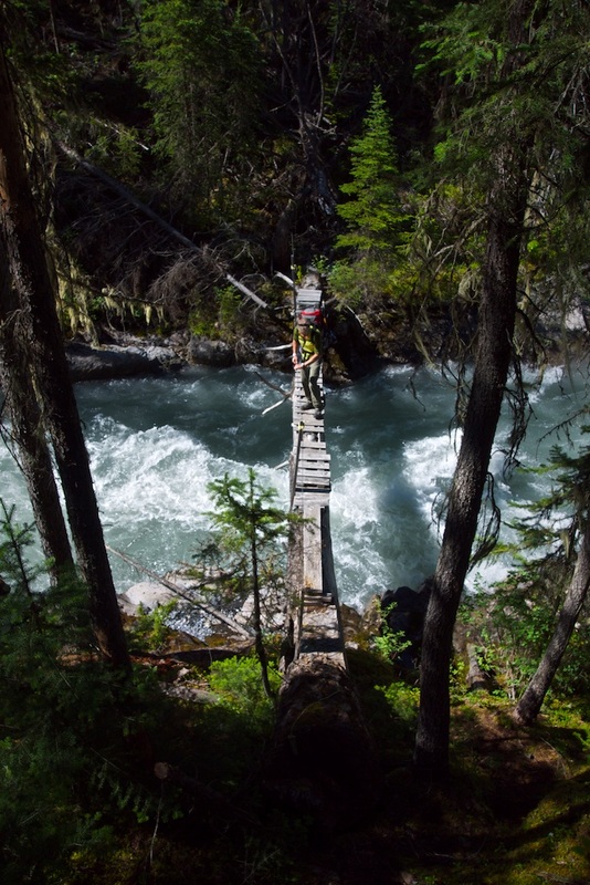
Palliser River Bridge
|
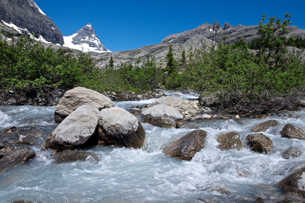
Mount Prince George
|
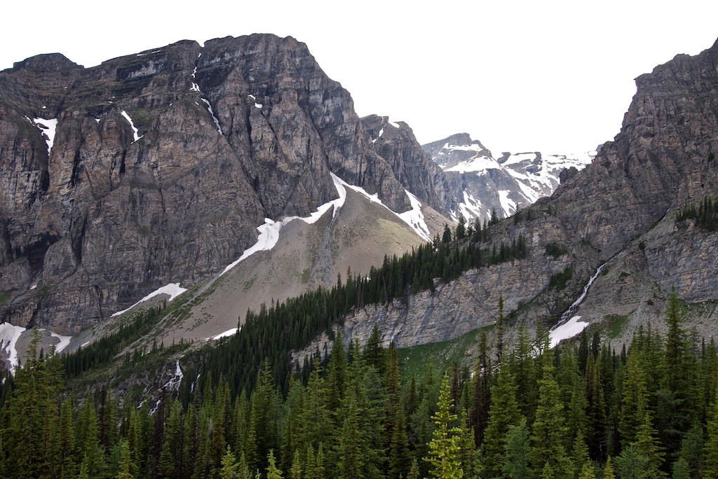
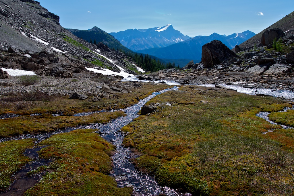
Base Camp Valley
|

Base Camp
|
Looking at Joffre From Base Camp
|
Mount Princess Mary with Joffre in the background
|
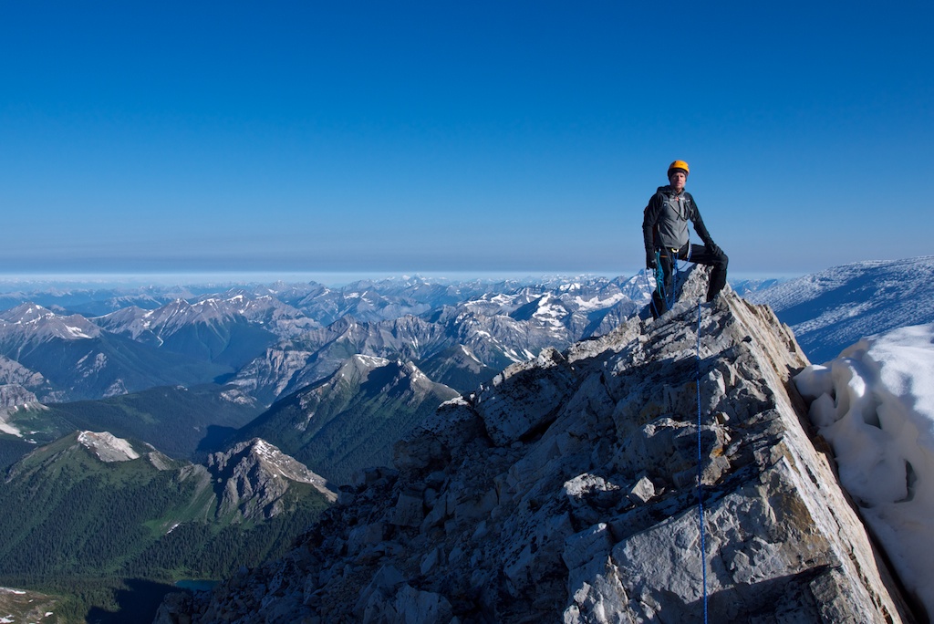
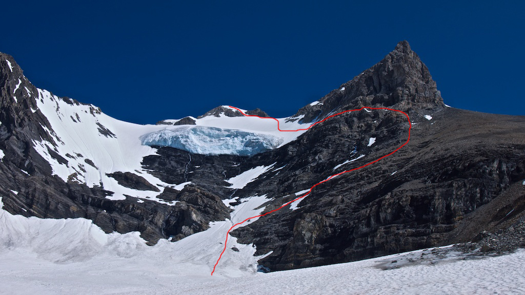
On the Summit
|
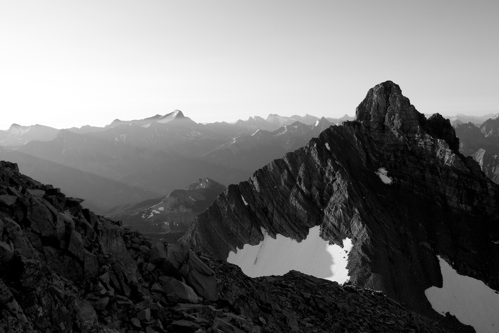
Descending from the SE Ridge Cliffbands
|
|
Info:
Time: 2-3 days Distance: 14km one-way Elevation Gain: 2160m Grade: II (very remote) Map: 82 J11 (Kananaskis Lakes) Climbing Gear: Glacier kit, Crampons, Ice Axe(s), Pickets and/or Ice Screws
Driving Directions: 61.2km gravel road
From HWY 1, drive 84 km south on HWY 93 or, From Radium, drive 19.8km north on HWY 93 Exit on Settlers Road on the east side of HWY 93 Take Settlers Road South East. 12.5km - left turn Kootenay/Palliser Road 14.6km - Turn right after Kootenay River Bridge 17.0km - Stay left Kootenay/Palliser Road 18.5km - Keep right on Kootenay/Palliser Road 26.5km - Continue straight through 29.2km - Continue straight through 31.2km - Keep left 34.7km - Keep right 36.8km - Turn left after Palliser River Bridge 41.0km - Take the furthest right of three roads 51.3km - Continue straight through 54.2km - Stay left 55.4km - Turn right and stay on main road 61.2km - Park on the top of the hill (look for what's left of a sign nailed to a tree as well as a cairn and flagging tape) 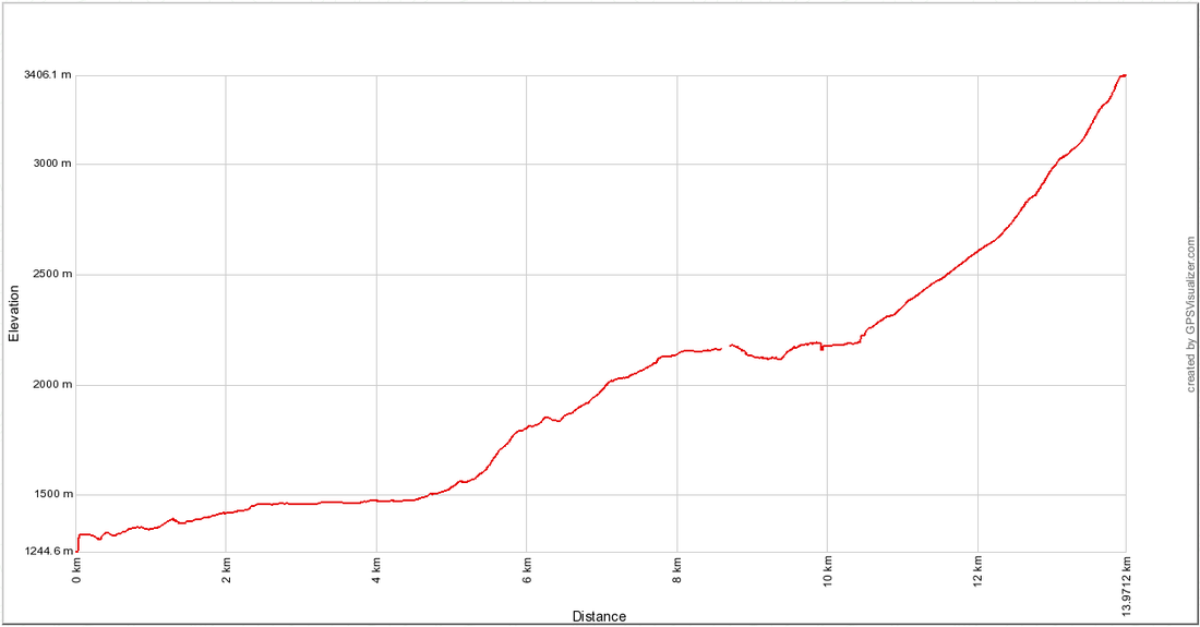
Elevation Profile (click to enlarge)
|
Directions:
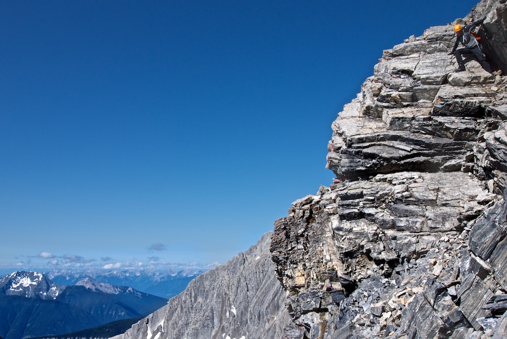
To Base Camp (5.5 hrs up and 2.5 hrs down) From the parking area, take a trail down the embankment and across the Palliser River on an Indiana Jones style log bridge. Continue into the Fynn Creek Valley and wander alongside the creek for 5km with moderate elevation gain before starting the long climb upwards. At 8.5km top out onto the large flat moraine with great views of Mount Prince George and a beautiful waterfall cascading down from the glacier above. Pick your way across this creek and onto the west shoulder of the moraine. From here, you will see several waterfalls falling off of Mount Princess Mary. Continue down for a few hundred feet of elevation loss before tying into a trail that works its way under the cliff bands and up the valley on the west side of Mount Princess Mary. As you crest the top of the waterfall, you will see base camp next to the creek in meadows full of wildflowers. This is one of the most scenic backcountry camping sites in the Rockies! To the Summit (6hrs return from Base Camp): From basecamp, the route is straight forward contouring around Mount Princess Mary as you gain elevation on snow slopes until standing under the cliff cathedral at the end of the valley. The hanging glacier stands guard in front of Mount King George. Work your way up steep snow and shale slopes on climbers right to gain the cliff bands underneath the ominous looking SE Ridge. Several options provide access to a bench that parallels the SE Ridge. (see photo) Either continue straight up through the cliff bands, or contour around to climbers right where several breaks give access to the upper cliff with a few fifth class moves. Traverse along the bench until you can access the glacier. Continue up and over the convex glacier/snow slope to the summit block. Depending on your comfort level, a few pieces of protection or two axes may be desired as you cross the lower slope, to protect from a high consequence fall. After cresting the slope, a thin gully provides snow climbing up the summit block and onto the short ridge and heavily corniced summit. 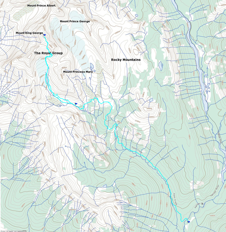
Map of Route (click to enlarge)
| ||||