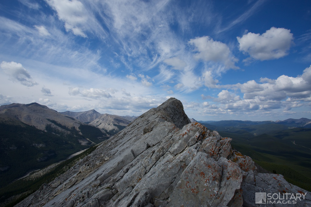
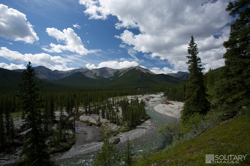
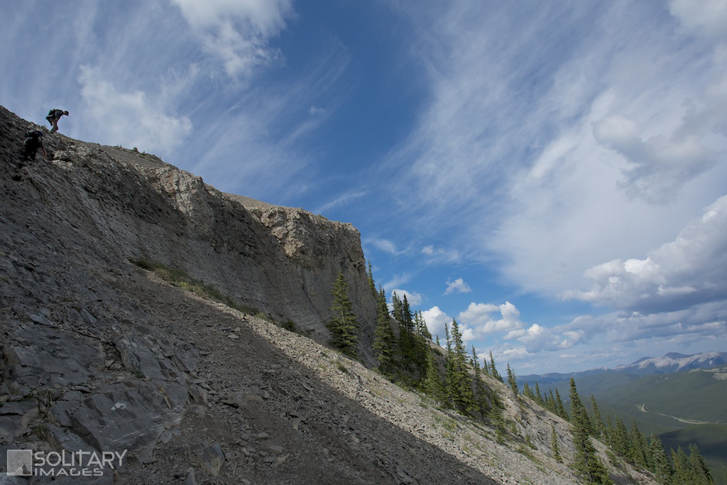
Nihahi Ridge
A popular hike/scramble that vaults you from the valley floor onto a never ending mountain ridge, separating the Rocky Mountains on the west from the rolling foothills to the east. Enjoy a short hike to expansive views at the south end of the ridge, or continue the adventure on a tightrope, across the entire length of the ridge. "Nihahi" is a Stoney word meaning rocky and is a great Mantra for those running the exposed rocky ridge with endless false summits.
Nihahi Ridge
Distance: 11.7 km return Elevation Gain: 728 m Total Elevation Gain: 809 m Physical Difficulty: 3/5 Technical Difficulty: 4/5 Time: 4-6 hrs return Nihahi Ridge Traverse Distance: 16.6 km one-way Elevation Gain: 930 m Total Elevation Gain: 1356 m / -1260 m Physical Difficulty: 4/5 Technical Difficulty: 5/5 Time: 7 - 9 hrs one-way 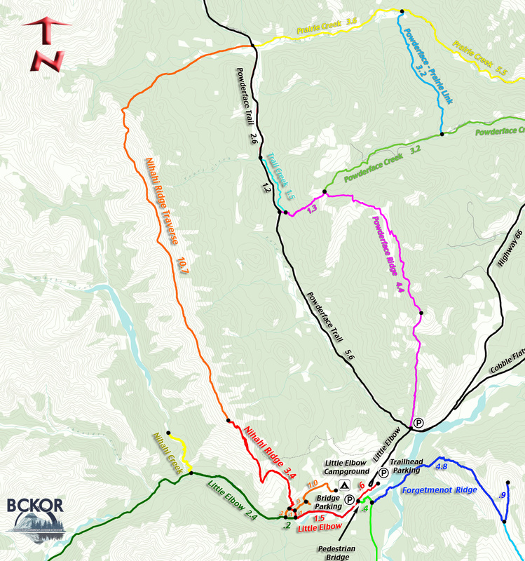
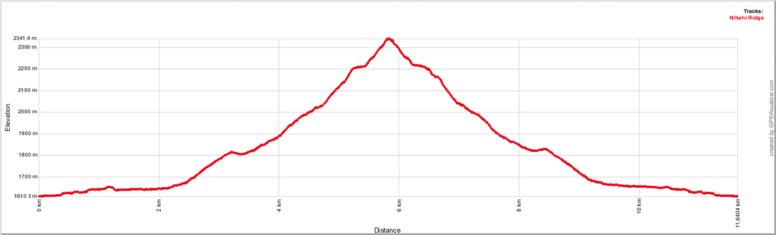
Nihahi Ridge Profile - Return
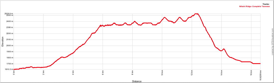
Nihahi Ridge Complete Traverse Profile - one-way
|
To Get Here: From the 4 way stop on HWY 22 next to Bragg Creek, take HWY 22 south to a T intersection. Turn right (westbound) on HWY 66. Travel 27.5 km to the intersection of Hwy 66 and Powderface Road. Turn left towards Little Elbow Campground and park in the Trailhead parking on your first left past Forgetmenot pond.
This section of HWY 66 is closed between Dec 1 to May 14 Trail Description:
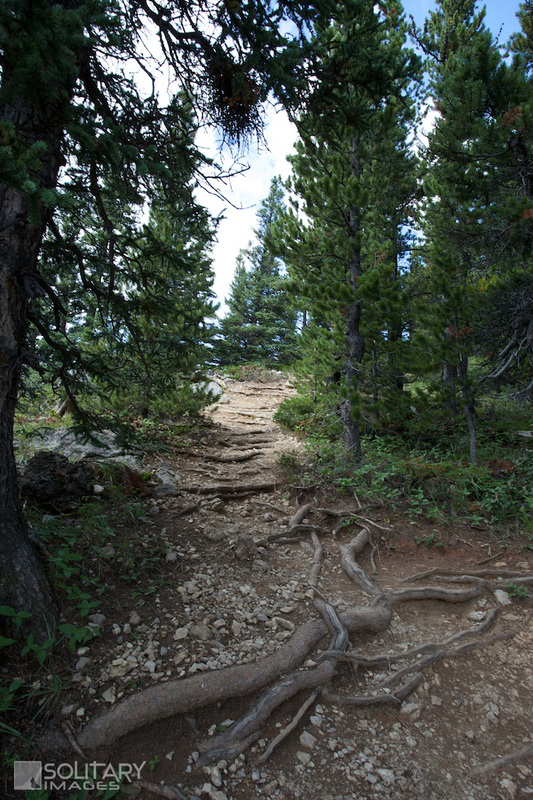
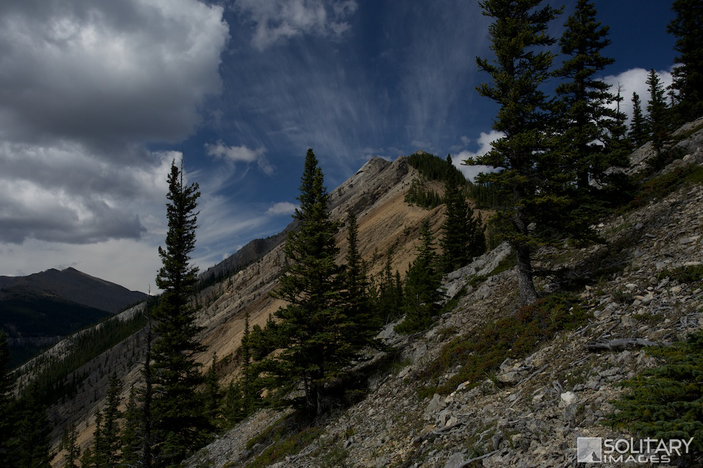
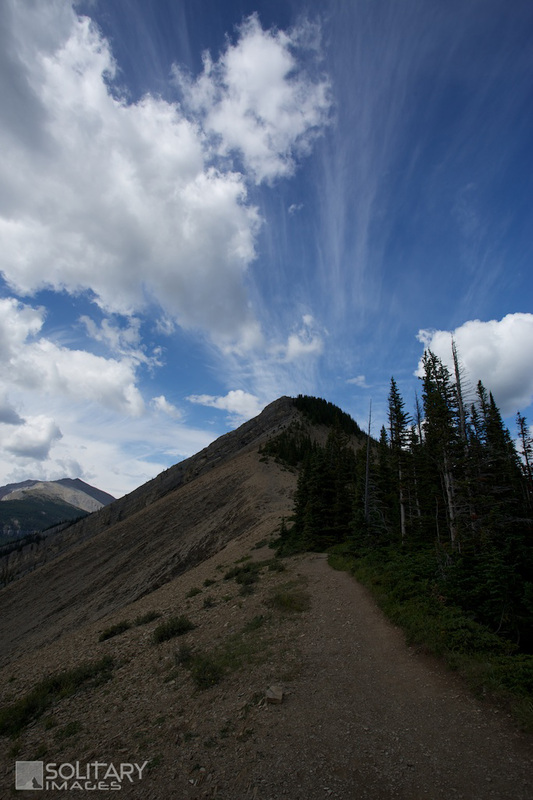
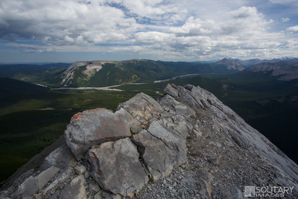
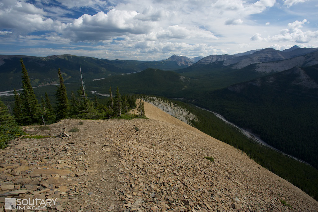
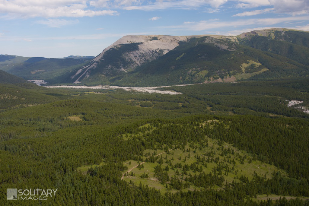
Nihahi Ridge From the Trailhead Parking lot, start SW alongside the Elbow River on Little Elbow Trail for 600m. The flood of 2013 has washed out some portions of this trail and you will need to make your way up the bank onto the roadside for a portion of it. 450m past the bridge, the Little Elbow Trail joins the campground road. Continue on the road past a locked gate to the Little Elbow trail sign. Follow the wide Little Elbow Trail for another 550m to the first trail junction on your right. Turn right and follow this trail for 150m to the next junction. Turn left and another 100m will take you to the Nihahi Ridge trail on your right. The climb up onto Nihahi Ridge begins as you wander through the dense forest and past a beautiful meadow before the earth gives way to reveal the name sake "Nihahi" rocky ground. The bank drops off the left side here and is protected with some posts and cable. Just past this hazard, their will be a sharp right turn as you crest the shoulder and start towards the ridge. Around 5km from the Trail head Parking, you'll be faced with a number of options where the trail braids across the scree slopes on the eastern side of the ridge. Always take the highest trail, appears to be a good policy as it provides the most direct and easiest route by avoiding the steep scree. As you continue upwards, the trail will drop off the eastern side again to avoid the cliff that forms along the ridge proper. Hike around the east side of the cliff where a small break in the rock, provides access upwards. This short section requires a few moderate scramble moves with mild exposure. The trail regains the ridge and winds back around the eastern slope. One more short scramble finally lands you on top of the ridge. Soak up the views, get your vertigo fix and head back down the same route that you came up. Nihahi Ridge Complete Traverse For those that like exposure and rocky ridges, the complete Nihahi ridge provides the ultimate traverse with 6.5km of straight ridge-top running. Continue along the never-ending ridge past five false summits until reaching the north summit. This portion of the route is quite straight forward with the odd area requiring you to deviate from the ridge to work your way around obstacles. After Reaching the North Summit, carefully pick your way off the ridge through a weakness that drops off the north side. Plot your exit route before leaving the alpine and entering the forest. Head east through several clearings and alongside Prairie Creek until reaching Powderface Trail road. | |||||||||||

Return to Bragg Creek Area Hiking/Running Trails (click here)
Return to Hiking/Running Trails (click here)
Return to Hiking/Running Trails (click here)