Bragg Creek & Kananaskis Outdoor Recreation
  • Home
    • About Us
    • Contact Us
    • Terms of Use
    • Bragg Creek Hamlet >
      • Bragg Creek & Kananaskis History
  • Christmas Trees
  • Film Fest in Bragg Creek!
  • Events
  • Camp
  • Bike
    • Mountain Biking >
      • MTB Trails
      • MTB Groups
      • MTB Races
      • MTB Guidebooks
      • MTB Trail Etiquette
    • Cycling >
      • Favorite Road Rides
      • Cycling Groups
      • Cycling Races
  • Hike/Run
    • Hiking/Running Trails
    • Hiking >
      • Hiking Groups
      • Hiking Events
      • Hiking Guidebooks
    • Trail Running >
      • Trail Running Groups
      • Trail Running Races
      • Trail Running Guidebooks
  • Ski
    • Nordic/Snowshoe >
      • Nordic & Snowshoe Areas
      • Nordic & Snowshoe Groups
      • Nordic & Snowshoe Races
      • Nordic & Snowshoe Guidebooks
    • Backcountry Skiing >
      • Backcountry Skiing Areas
      • Backcountry Skiing Groups
      • Backcountry Skiing Guidebooks
  • Climb
    • Rock Climbing >
      • Popular Climbing Areas
      • Climbing Guidebooks
    • Alpine Climbing >
      • Popular Alpine Climbs
      • Alpine Climbing Guidebooks
    • Ice Climbing >
      • Ice Climbing Guidebooks
    • Climbing Groups
  • Paddle
    • Favorite Lakes
    • Favorite Rivers
    • Paddling Groups
    • Paddling Events
    • Paddling Guidebooks
  • Fish
    • Fishing Areas
    • Fishing Guidebooks
    • Fishing Groups
  • Picnic
    • Bragg Creek Area
    • Canmore Area
    • Central Kananaskis Area
    • Highwood Area
    • Peter Lougheed Area
    • Sheep River Area
    • Sibbald Area
  • Equestrian
    • Favorite Equestrian Areas
    • Equestrian Groups
    • Equestrian Events
    • Equestrian Guidebooks
  • Caving
    • Caving Areas
    • Caving Groups
    • Caving Guidebooks
  • Off-Highway Vehicles
    • Favorite OHV Areas
    • OHV Groups
    • OHV Races
  • Snowmobile
    • Favorite Snowmobile Areas
    • Snowmobile Groups
  • Logging Kananaskis!
    • Structure Retention Directive
    • Current Logging Plans
    • Logging vs. Recreation
    • How to Help!
  • Maps
  • Photos
  • Link Page

Powderface Ridge

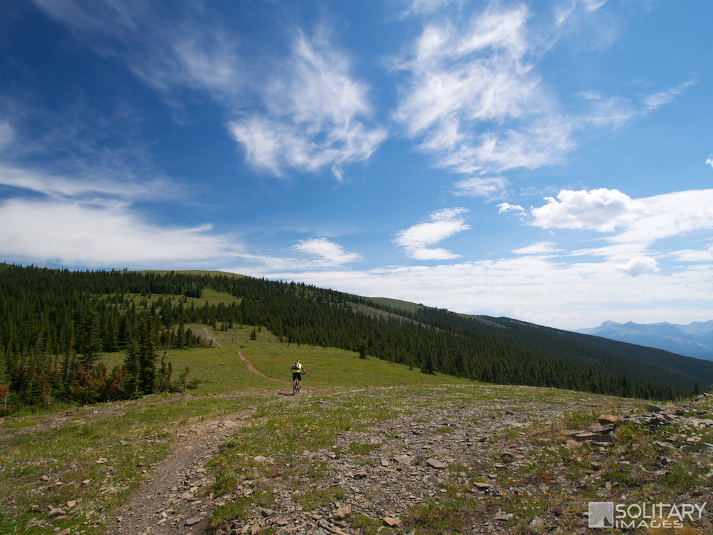
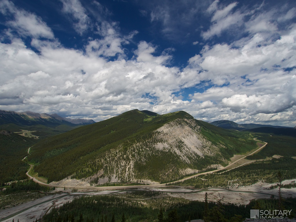
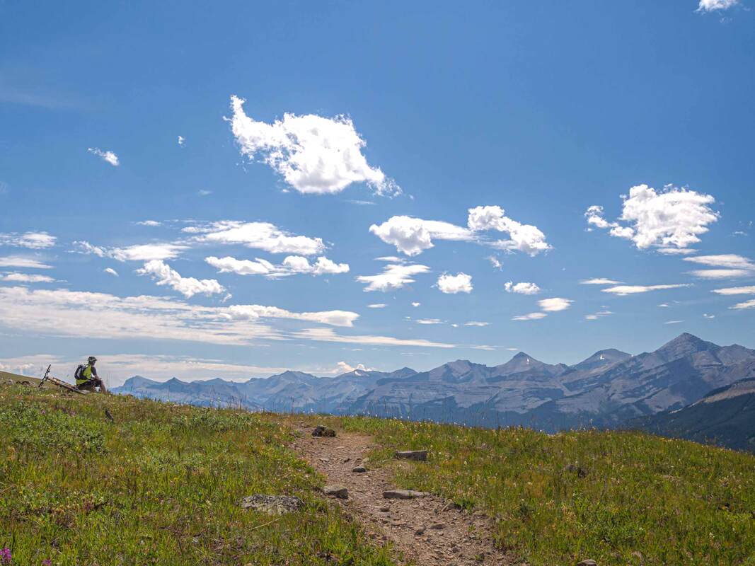
A grueling grind on an aesthetic mountain ridge. Steep and technical, with lots of large loose rock combined with a view of the Rockies to the west and the foothills to the east, make this an athletic test piece with constant rewards.

Picture
Picture
Picture
Picture
Picture
Picture
Style: Cross-country
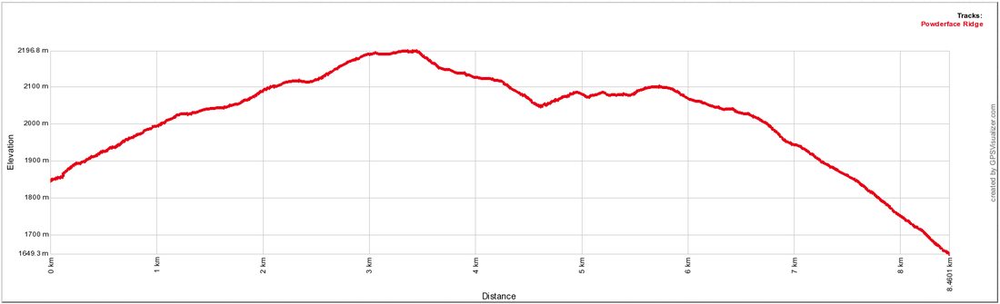
Distance: 8.5km one-way
Elevation Gain: 432m / -627m
Total Elevation Gain: 348m
Physical Difficulty: 4/5
Technical Difficulty: 4/5
Time: 2 - 3 hours
Picture
Picture
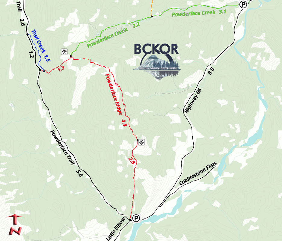
To Get Here: From the 4 way stop on HWY 22 next to Bragg Creek, take HWY 22 south to a T intersection. Turn right (westbound) on HWY 66. Travel 27.6 km west down HWY 66 to the end of the highway and park next to the Powderface Trail entrance.

This section of HWY 66 is closed between Dec 1 to May 14
Trail Description:

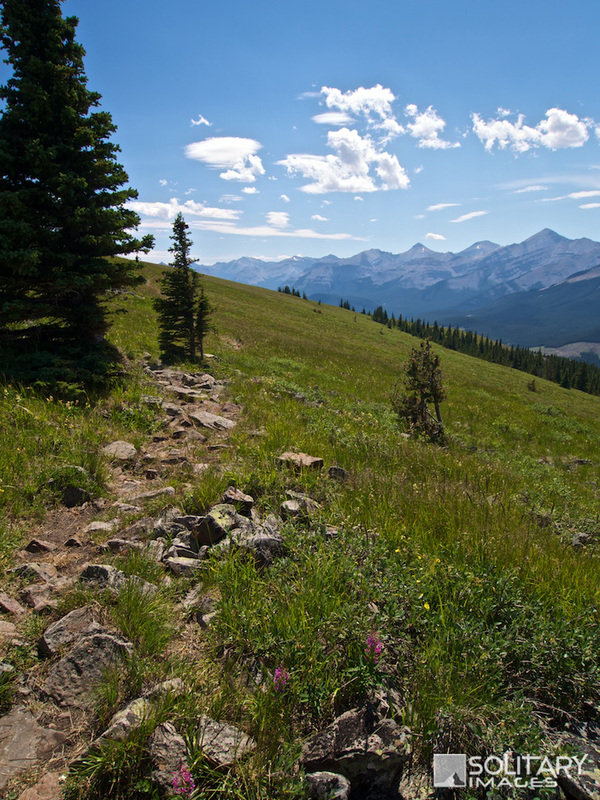
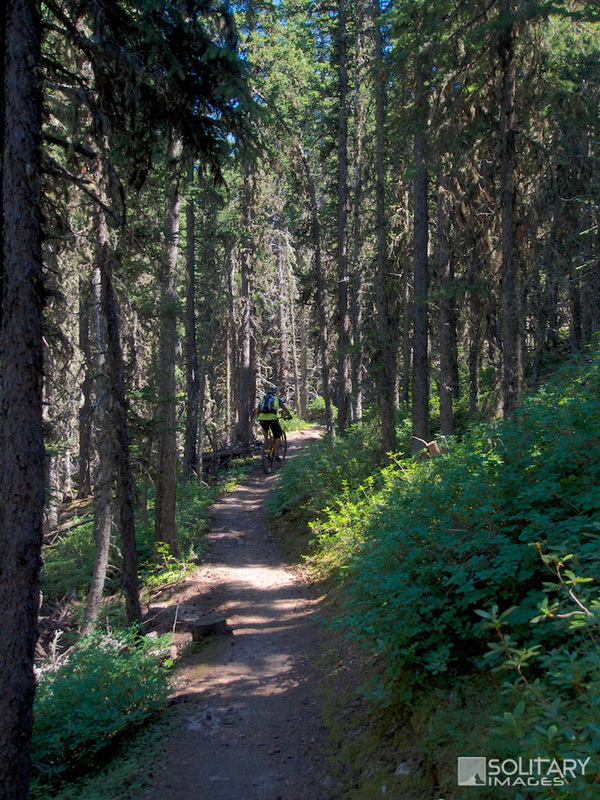
Powderface Ridge can be accessed, or combined, with a number of trails but generally should be ridden from north to south. If you only plan on riding Powderface Ridge, park at the pullout next to the Little Elbow turnoff on Highway 66. Drive/ride up Powderface Trail (road) for 5.6km to the Powderface Ridge trailhead located at the road highpoint. Turn right and start a steep technical climb for 1.3km past the Trail Creek Junction, to a saddle on top of Powderface Ridge, at the Powderface Creek intersection. A short scramble for 250m north-west of the intersection provides great views. Turn south and continue climbing through the trees and out into the open alpine meadow. Work your way over the rocky ground enjoying the wide open meadows to the trail summit. 2km from the Powderface creek intersection, the trail takes a sharp left and drops off the east side of the ridge and down a fun descent through the forest. A quick climb up brings you back onto the open ridge top. If you want to stop and soak in an awesome panarama, leave the trail and hike 200m up the ridge to the south summit cairn overlooking the Elbow Valley! The trail drops off the SW edge of the ridge in a steep wide and loose track. Choose your own adventure as the trail splits and winds around trees dropping fall line in a Slalom style descent all the way to Hwy 66.
powderface_ridge.gpx
File Size: 126 kb
File Type: gpx
Download File


go to Bragg Creek Area MTB Trails (click here)
go to Mountain Bike Trails (click here)

Follow @BCKOR

Contact
Terms of Use
Copyright ©  2013-2014 Bragg Creek & Kananaskis Outdoor Recreation (BCKOR Ltd.) All Rights Reserved.