Bragg Creek & Kananaskis Outdoor Recreation
  • Home
    • About Us
    • Contact Us
    • Terms of Use
    • Bragg Creek Hamlet >
      • Bragg Creek & Kananaskis History
  • Christmas Trees
  • Film Fest in Bragg Creek!
  • Events
  • Camp
  • Bike
    • Mountain Biking >
      • MTB Trails
      • MTB Groups
      • MTB Races
      • MTB Guidebooks
      • MTB Trail Etiquette
    • Cycling >
      • Favorite Road Rides
      • Cycling Groups
      • Cycling Races
  • Hike/Run
    • Hiking/Running Trails
    • Hiking >
      • Hiking Groups
      • Hiking Events
      • Hiking Guidebooks
    • Trail Running >
      • Trail Running Groups
      • Trail Running Races
      • Trail Running Guidebooks
  • Ski
    • Nordic/Snowshoe >
      • Nordic & Snowshoe Areas
      • Nordic & Snowshoe Groups
      • Nordic & Snowshoe Races
      • Nordic & Snowshoe Guidebooks
    • Backcountry Skiing >
      • Backcountry Skiing Areas
      • Backcountry Skiing Groups
      • Backcountry Skiing Guidebooks
  • Climb
    • Rock Climbing >
      • Popular Climbing Areas
      • Climbing Guidebooks
    • Alpine Climbing >
      • Popular Alpine Climbs
      • Alpine Climbing Guidebooks
    • Ice Climbing >
      • Ice Climbing Guidebooks
    • Climbing Groups
  • Paddle
    • Favorite Lakes
    • Favorite Rivers
    • Paddling Groups
    • Paddling Events
    • Paddling Guidebooks
  • Fish
    • Fishing Areas
    • Fishing Guidebooks
    • Fishing Groups
  • Picnic
    • Bragg Creek Area
    • Canmore Area
    • Central Kananaskis Area
    • Highwood Area
    • Peter Lougheed Area
    • Sheep River Area
    • Sibbald Area
  • Equestrian
    • Favorite Equestrian Areas
    • Equestrian Groups
    • Equestrian Events
    • Equestrian Guidebooks
  • Caving
    • Caving Areas
    • Caving Groups
    • Caving Guidebooks
  • Off-Highway Vehicles
    • Favorite OHV Areas
    • OHV Groups
    • OHV Races
  • Snowmobile
    • Favorite Snowmobile Areas
    • Snowmobile Groups
  • Logging Kananaskis!
    • Structure Retention Directive
    • Current Logging Plans
    • Logging vs. Recreation
    • How to Help!
  • Maps
  • Photos
  • Link Page

Prairie View

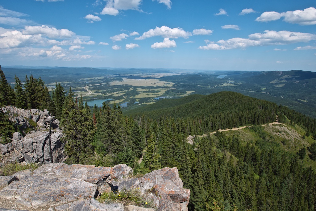
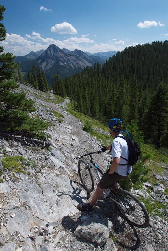
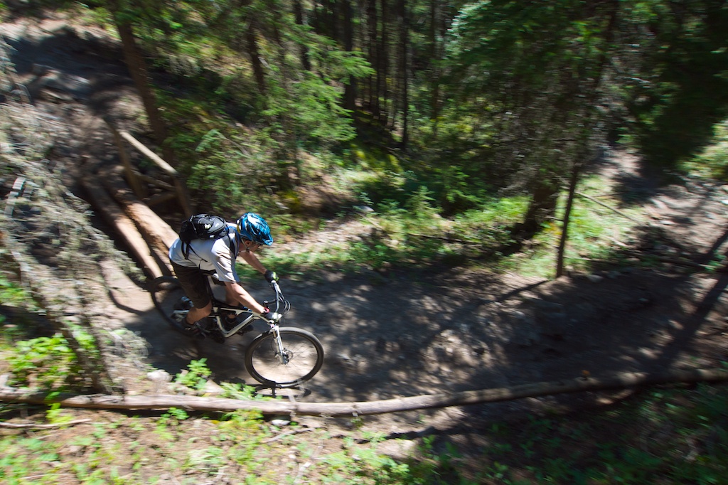
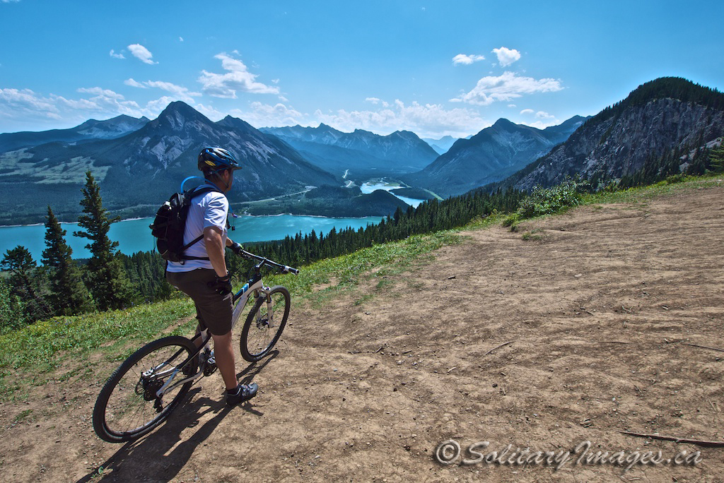
Not for the weak of heart, lung or calf. A fire road that starts off at a deceptively easy angle before increasing to the point of no ride. A great loop with amazing views of both the prairies and the Kananaskis Mountain Range, followed by an arm pumping technical downhill.

Picture
Picture
Picture
Picture

Style: Cross-country
Distance: 15km
Elevation Gain: 521m
Total Elevation Gain: 634m
Physical Difficulty: 3/5
Technical Difficulty: 3/5
Time: 2-4 hours
Picture
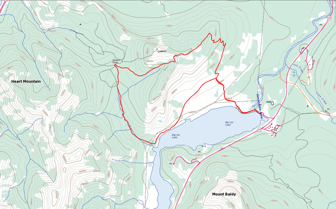
Prairie View - Map (Click to Enlarge)
Picture
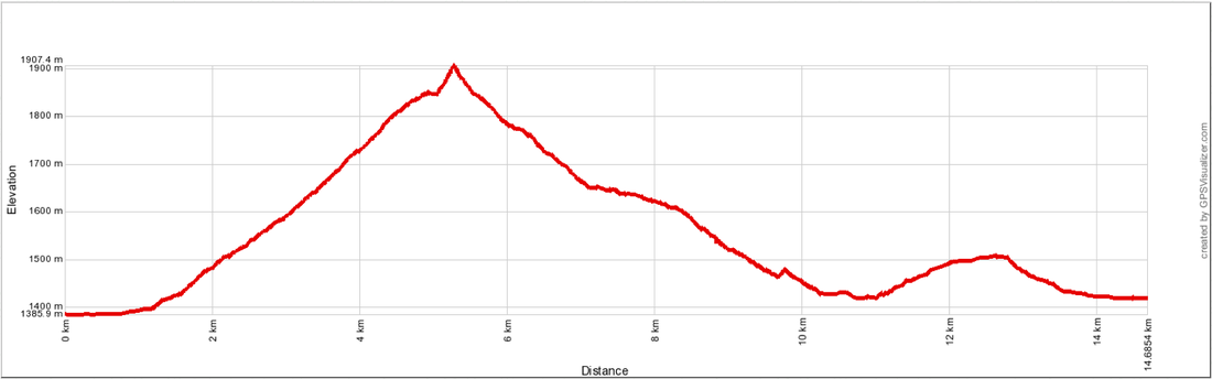
Prairie View - Elevation Profile (Click to Enlarge)
To Get Here: From Hwy 1 and Hwy 40 intersection, take Hwy 40 for 9.1km to the Barrier Lake dam turnoff on your right.
Trail Description:

Start off on the fire road at the end of the parking lot, that crosses the dam. Continue on the fire road as it progressively gets steeper and steeper until you have to shoulder your bike and scramble up a rock bluff to the top. A gigantic reflective shield will mark the end of the climb and an amazing viewpoint to make you forget about that radiating pain coming from your legs. From the reflective shield, work your way down the loose rock until you spot a single track trail heading back into the woods to the west. Follow this trail down technical steeps that get more extreme every year with continued erosion and tree roots. Upon reaching the trail sign at Jewel Pass summit, turn left and follow Jewel Pass southbound to Barrier Lake. Keep left past a number of adjoining trails, climbing back up a short distance until reaching the main fireroad that you rode in on.
Prairie View.gpx
File Size: 144 kb
File Type: gpx
Download File


go to Sibbald Area MTB Trails (click here)
go to Mountain Bike Trails (click here)

Follow @BCKOR

Contact
Terms of Use
Copyright ©  2013-2014 Bragg Creek & Kananaskis Outdoor Recreation (BCKOR Ltd.) All Rights Reserved.