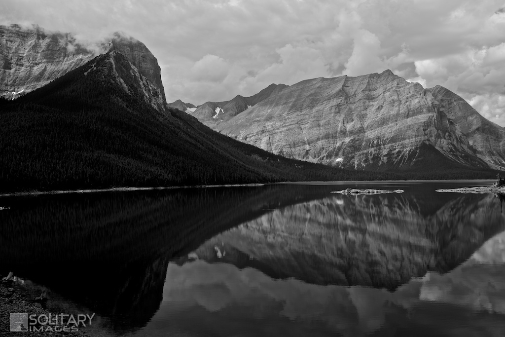
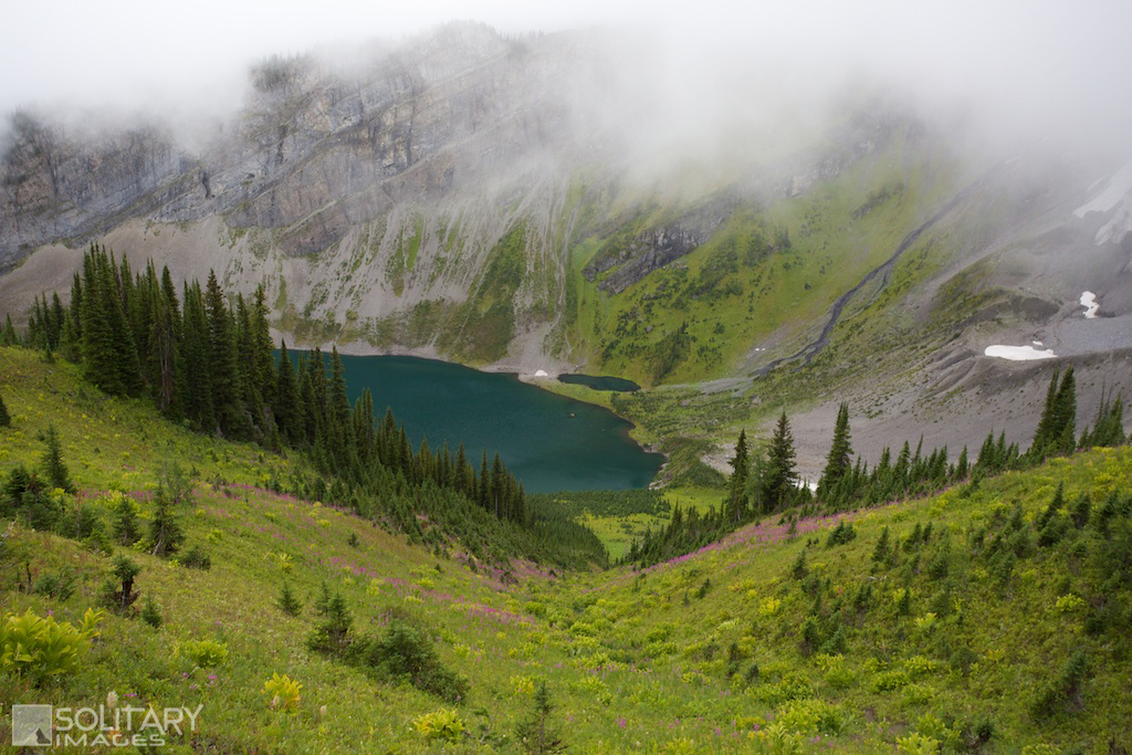
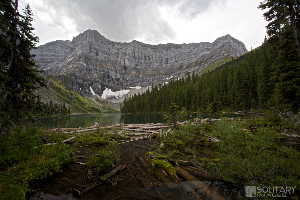
Rawson Lake & Sarrail Ridge
One of the most popular hikes in all of Kananaskis and for good reason. A short trail vaults you from Upper Kananaskis Lake to a tranquil crystal clear jade lake nestled in an alpine bowl surrounded by the intimidating Mount Sarrail. Stop and enjoy the peaceful surroundings at Rawson Lake, or continue up onto Sarrail Ridge for a birds eye view of the entire area.
Rawson Lake
Distance: 7.0 km return Elevation Gain: 270 m Total Elevation Gain: 298 m Physical Difficulty: 2/5 Technical Difficulty: 2/5 Time: 2-4 hrs return 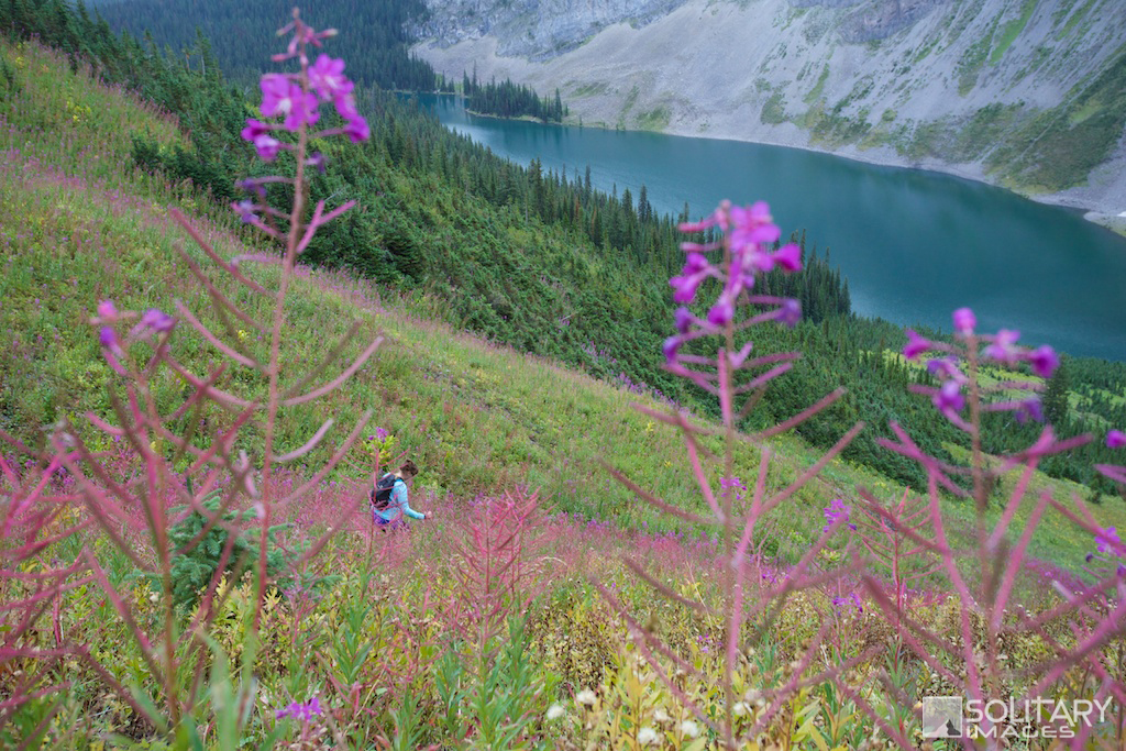
Sarrail Ridge
Distance: 11.8 km return Elevation Gain: 622 m Total Elevation Gain: 667 m Physical Difficulty: 3/5 Technical Difficulty: 3/5 Time: 3.5-6 hrs return 
|
To Get Here: From Hwy 1, take Hwy 40 south for 50km. Just before the winter gates, turn right onto Kananaskis Lakes Trail and continue for 12.6km to the Upper and Lower Lake intersection. Turn left onto the unmarked road to the Upper Kananaskis Lake parking lot and park at the south lot, furthest from the boat launch.
Trail Description:
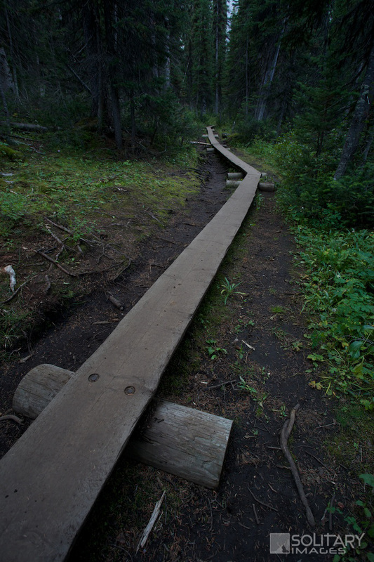
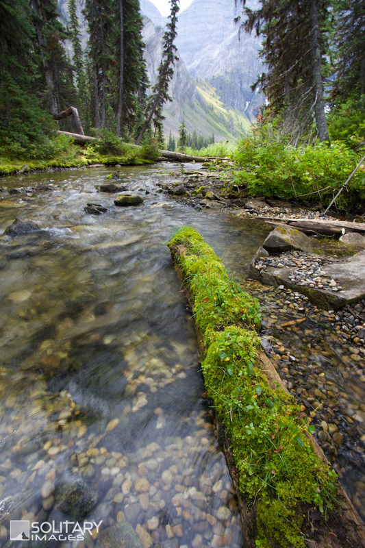
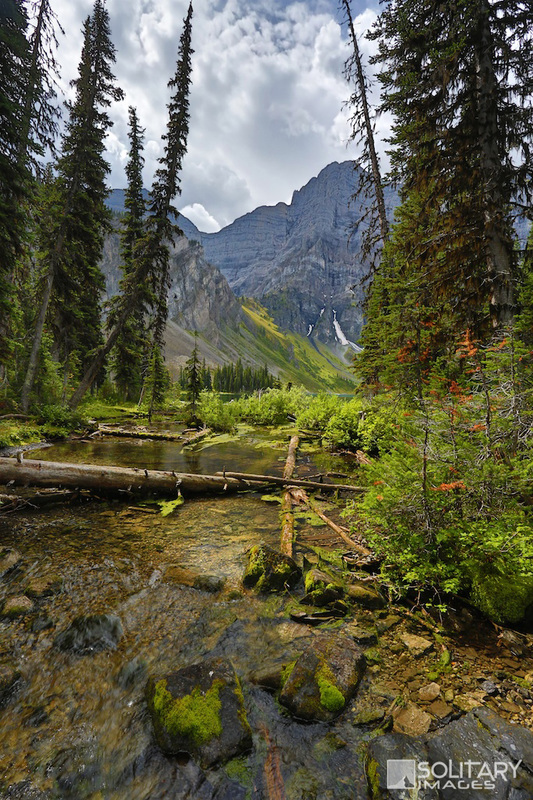
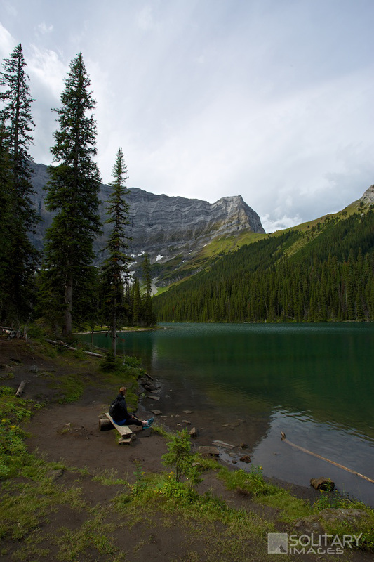
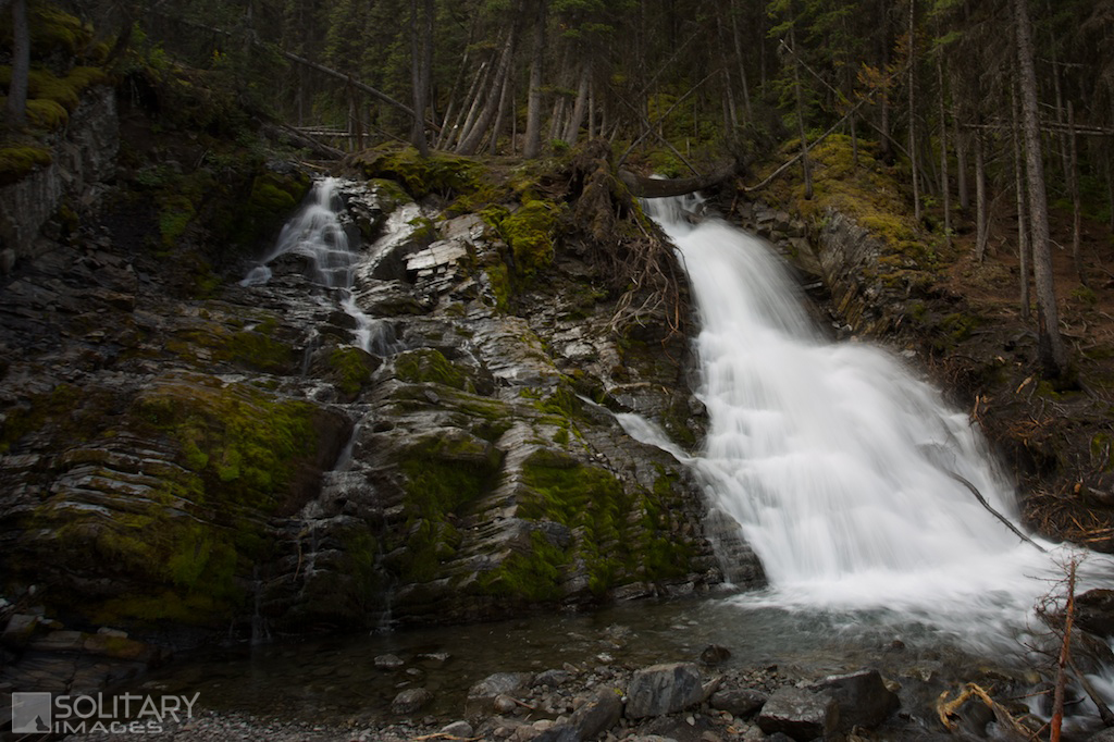
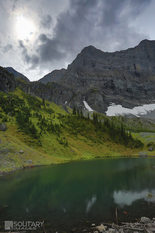
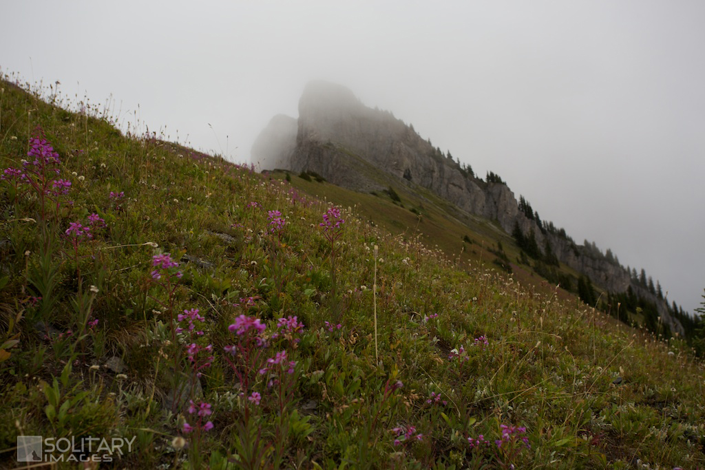
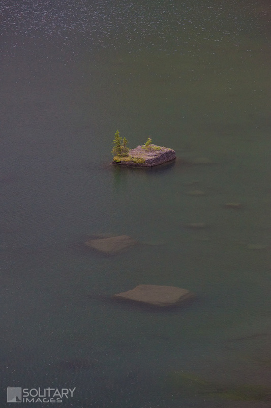
Rawson Lake From the Trailhead Parking lot, head south clockwise around the Upper Kananaskis Trail. 1 km from the parking lot, you'll cross under a small waterfall where Sarrail Creek enters Upper Kananaskis Lake. Two hundred meters past the waterfall, turn left onto Rawson Lake trail and start the climb up to Rawson Lake. Continue through the dense forest and lush undergrowth for another 2.3km until arriving at North end of the lake. The trail continues around the South-East edge of the lake where you'll find lots of spots along the shore to stop and take all the views in, or drop a line into one of the most scenic fishing backdrops possible. Sarrail Ridge If you're feeling energetic and want to experience an even more tantalizing view, continue around the lake and look for an avalanche path that climbs steeply up to the saddle on Sarrail Ridge. Scramble up a faint trail that runs on climber's right side of the gully until topping out on the grassy ridge. From here wander over to the saddle where you will have a birdseye view of both Rawson Lake to the south and Upper Kananaskis Lake to the north. The ridge is open and you can easily wander north-east to the ridge summit for a 360 degree view. 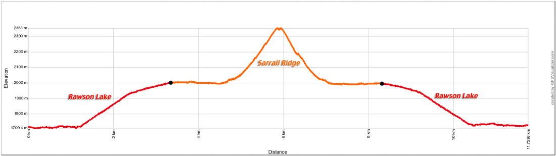
Rawson Lake & Sarrail Ridge Profile
| ||||||||||||