Bragg Creek & Kananaskis Outdoor Recreation
  • Home
    • About Us
    • Contact Us
    • Terms of Use
    • Bragg Creek Hamlet >
      • Bragg Creek & Kananaskis History
  • Christmas Trees
  • Film Fest in Bragg Creek!
  • Events
  • Camp
  • Bike
    • Mountain Biking >
      • MTB Trails
      • MTB Groups
      • MTB Races
      • MTB Guidebooks
      • MTB Trail Etiquette
    • Cycling >
      • Favorite Road Rides
      • Cycling Groups
      • Cycling Races
  • Hike/Run
    • Hiking/Running Trails
    • Hiking >
      • Hiking Groups
      • Hiking Events
      • Hiking Guidebooks
    • Trail Running >
      • Trail Running Groups
      • Trail Running Races
      • Trail Running Guidebooks
  • Ski
    • Nordic/Snowshoe >
      • Nordic & Snowshoe Areas
      • Nordic & Snowshoe Groups
      • Nordic & Snowshoe Races
      • Nordic & Snowshoe Guidebooks
    • Backcountry Skiing >
      • Backcountry Skiing Areas
      • Backcountry Skiing Groups
      • Backcountry Skiing Guidebooks
  • Climb
    • Rock Climbing >
      • Popular Climbing Areas
      • Climbing Guidebooks
    • Alpine Climbing >
      • Popular Alpine Climbs
      • Alpine Climbing Guidebooks
    • Ice Climbing >
      • Ice Climbing Guidebooks
    • Climbing Groups
  • Paddle
    • Favorite Lakes
    • Favorite Rivers
    • Paddling Groups
    • Paddling Events
    • Paddling Guidebooks
  • Fish
    • Fishing Areas
    • Fishing Guidebooks
    • Fishing Groups
  • Picnic
    • Bragg Creek Area
    • Canmore Area
    • Central Kananaskis Area
    • Highwood Area
    • Peter Lougheed Area
    • Sheep River Area
    • Sibbald Area
  • Equestrian
    • Favorite Equestrian Areas
    • Equestrian Groups
    • Equestrian Events
    • Equestrian Guidebooks
  • Caving
    • Caving Areas
    • Caving Groups
    • Caving Guidebooks
  • Off-Highway Vehicles
    • Favorite OHV Areas
    • OHV Groups
    • OHV Races
  • Snowmobile
    • Favorite Snowmobile Areas
    • Snowmobile Groups
  • Logging Kananaskis!
    • Structure Retention Directive
    • Current Logging Plans
    • Logging vs. Recreation
    • How to Help!
  • Maps
  • Photos
  • Link Page

Tryst Lake Chutes / Super Slope

A popular tour offering two different aspects from the same ridge. Spend a day skiing steep chutes and finish it off with a long descent into the parallel valley. This area gets tracked out quick so get there early.
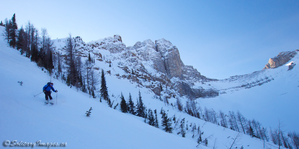
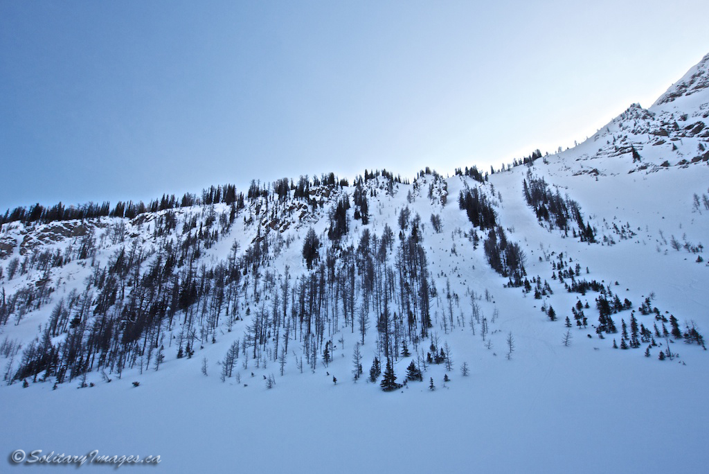
Picture
Skiing Tryst Chutes
Picture
Climbing the Ridge
Picture
Top of the Ridge
Picture
Steep Chutes
Picture
The Chutes

Tryst Lake
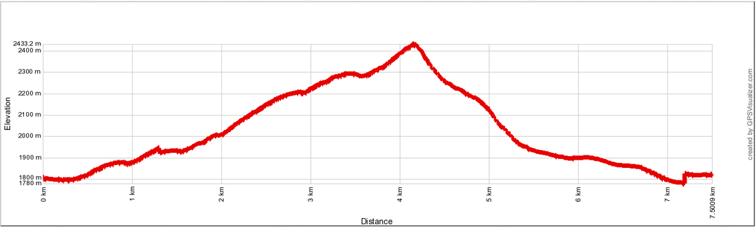
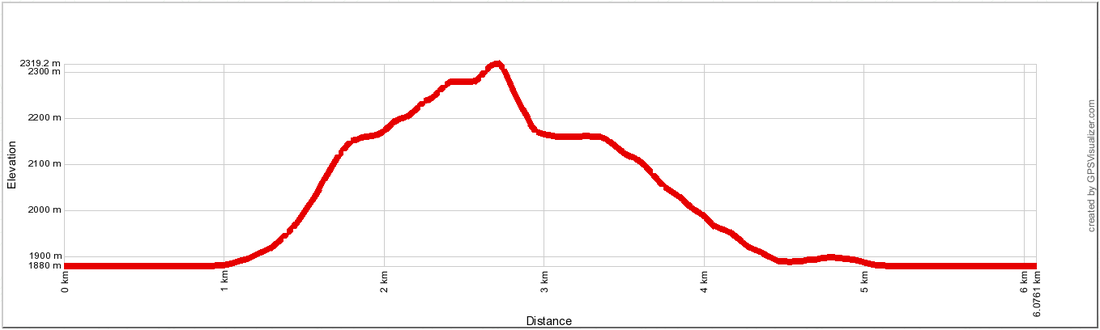
Distance: 6.1 km
Elevation Gain: 440m
Ski Run Rating: Expert
Avalanche Terrain Rating: Challenging
Map: 82 J/14
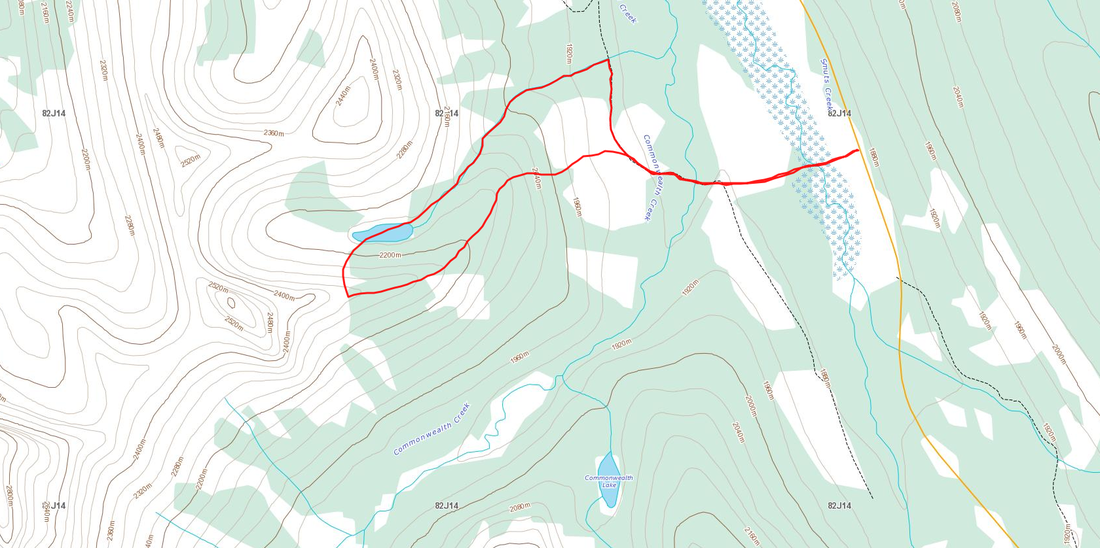
Picture
Picture
Super Slope
Distance: 6.3km
Elevation Gain: 450m
Physical Difficulty: 2/5
Technical Difficulty: 4/5
Avalanche Terrain Rating: Challenging
Map: 82 J/14
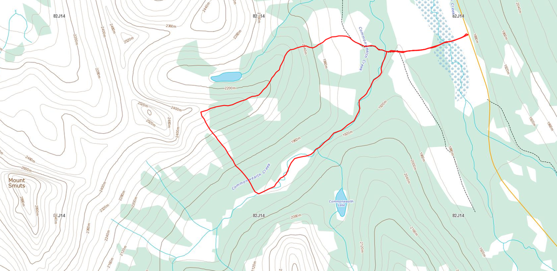
Picture
Picture
To Get Here:
From Canmore take Smith-Dorrien/Spray Lakes Trail for 38.4km and park on the side of the road 2.2km past the Mount Shark/Engadine Lodge turn-off.

Route Description:
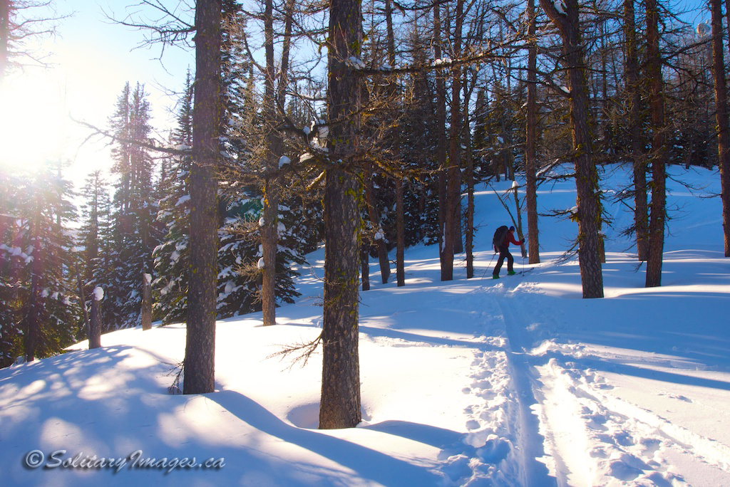
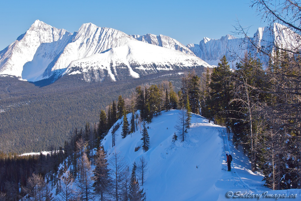
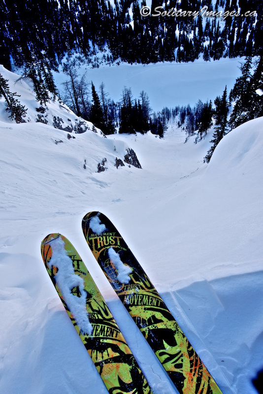
From the road, drop down across the flats and up a small trail through the trees until you gain an old road. Turn right and follow this road until you come across an old cut block on your left. Leave the road and start working your way up the cut block trending right onto the ridge. Keep working your way up the ridge. At one point it'll drop down slightly before continuing upwards. The Fist will eventually come to view and the ridge will continue towards it and narrow. The ridge will eventually cliff out at the Fist and you'll need to decide whether you want to drop North down the chutes into Tryst Lake or South down Super Slope into Commonwealth Creek.

Tryst Lake Chutes:
Tryst Lake Chutes run along the ridge offering a number of short but fun steep chutes dropping 150m to the lake. Make sure you are comfortable with the stability before dropping in. To lap the runs, work your way from down the drainage and back onto the ridge.When you're done playing, head down the drainage until you connect with the road. Turn right and follow it until you reconnect with your up-track.

Super Slope:
Continue up the ridge past the chutes until the Fist blocks your past. Trend left and cross through the thin trees until reaching the slide paths or Super Slope that run South into Commonwealth. This is a large open slope presenting a large avalanche hazard. If you're unsure of the conditions, this is not the place to be. Enjoy the run down and pick your way through trees at the bottom until you reach the drainage. Follow the drainage out to the old road. Turn right and follow your up-track back out to the road.

Return to Backcountry Skiing Areas (click here)

Follow @BCKOR

Contact
Terms of Use
Copyright ©  2013-2014 Bragg Creek & Kananaskis Outdoor Recreation (BCKOR Ltd.) All Rights Reserved.