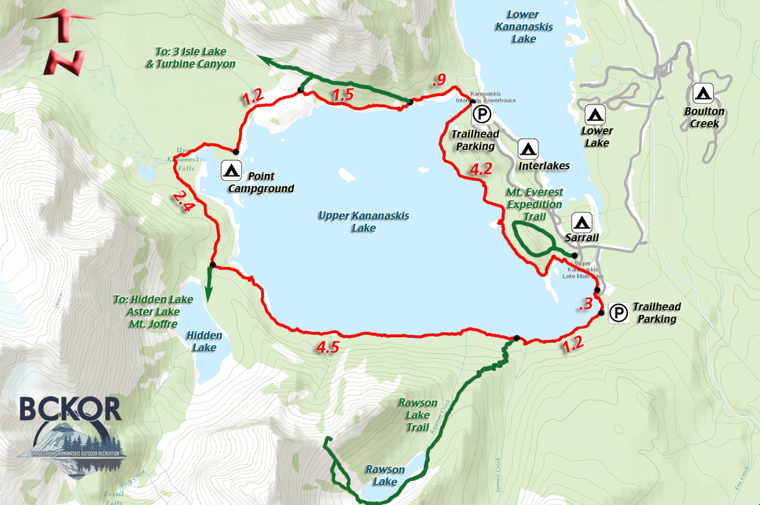
Upper Kananaskis Circuit
A landscape photographer's viewfinder with a long wander around a large picturesque alpine lake surrounded by rugged mountains. Start at any of the parking areas next to the lake, and go in either direction while enjoying the constantly changing views.
Upper kananaskis Circuit
Distance: 16.7 km return Elevation Gain: 41.5 m Total Elevation Gain: 356 m Physical Difficulty: 2/5 Technical Difficulty: 2/5 Time: 4.5-6 hrs return 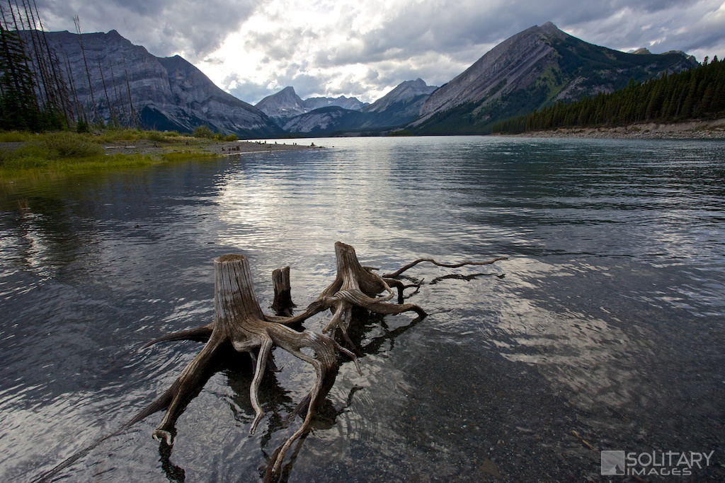
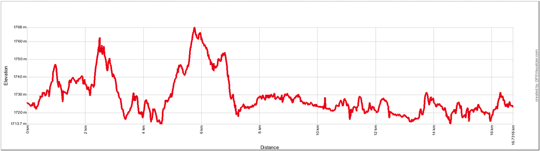
Upper Kananaskis Circuit Elevation Profile
|
To Get Here: From Hwy 1, take Hwy 40 south for 50km. Just before the winter gates, turn right onto Kananaskis Lakes Trail and continue for 12.6km to the Upper and Lower Lake intersection. Turn right and continue past the Interlake campground to the north parking lot located next to the dam separating Upper and Lower Kananaskis Lake.
Trail Description:
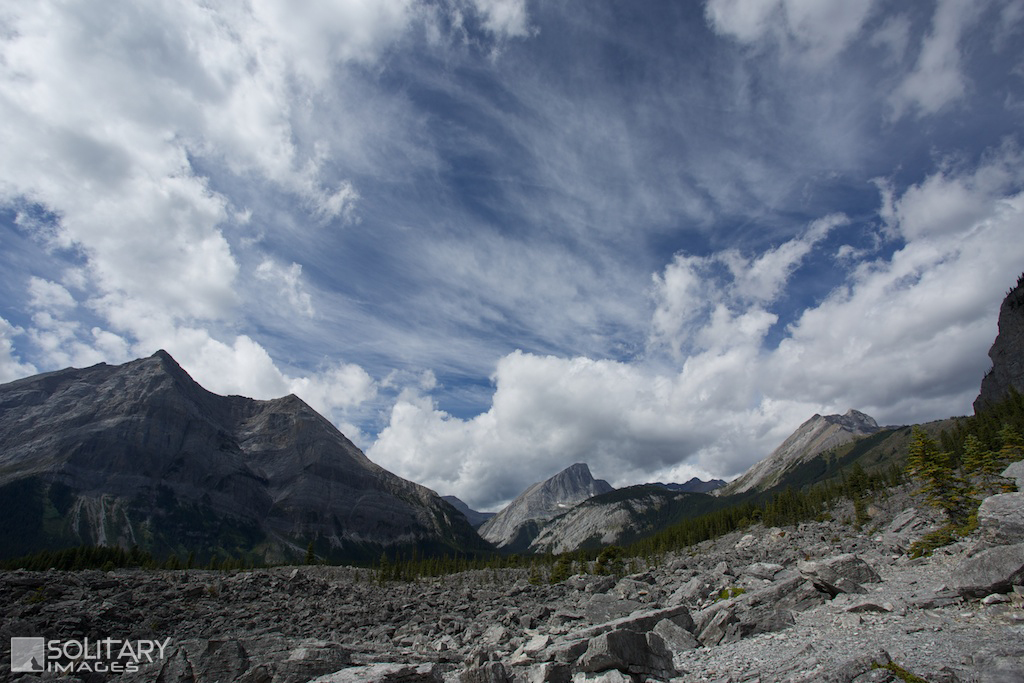
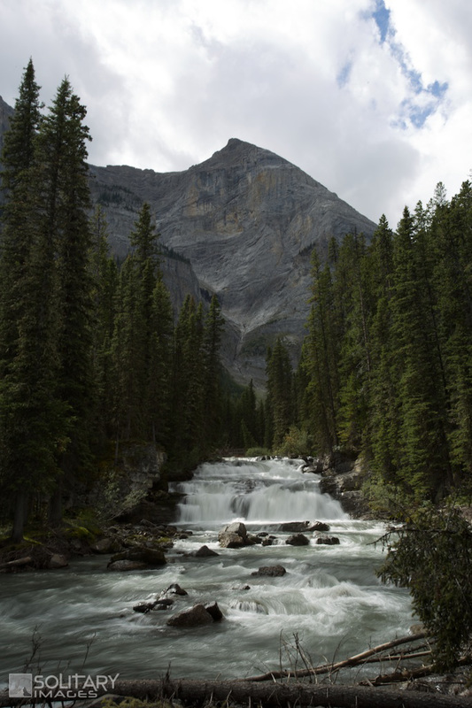
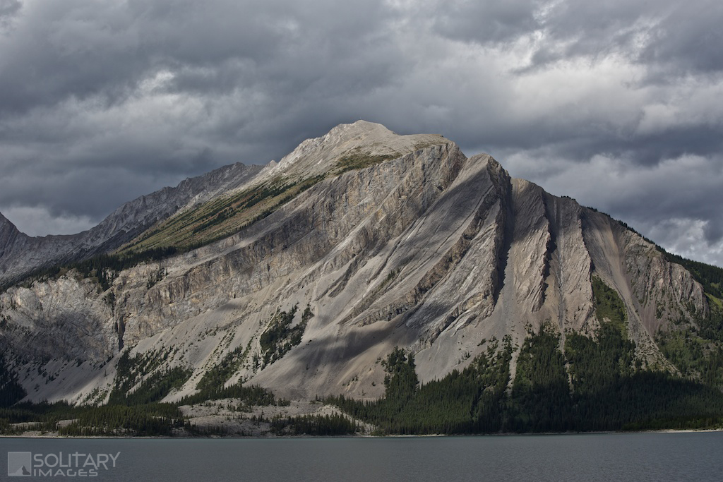
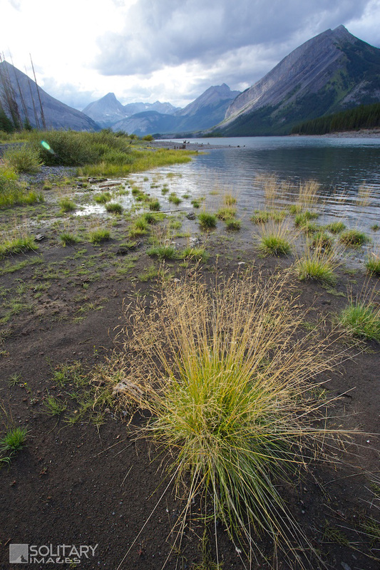
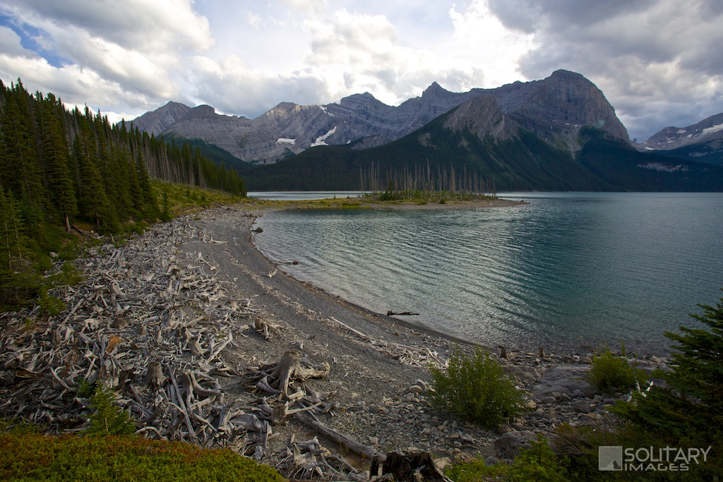
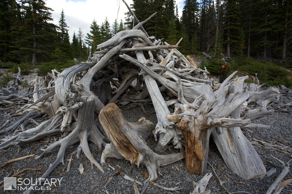
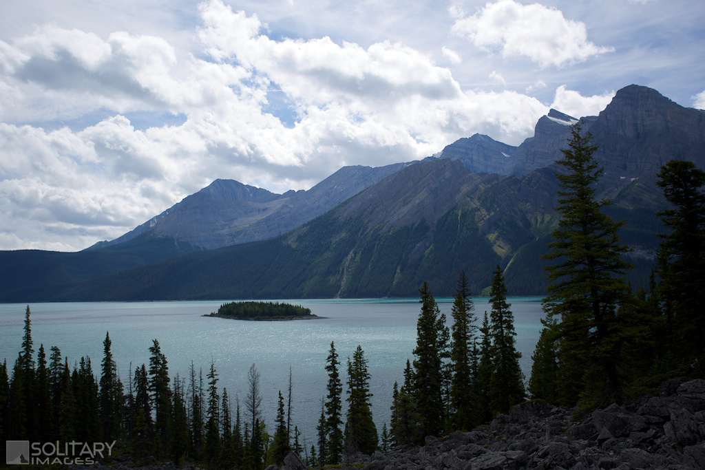
While you can start this trail from any of the parking lots around the lake, this description starts from the north parking lot and goes counter-clockwise. Cross over the Upper Kananaskis Lake dam and start down the wide open trail. Throughout the circuit, there are lots of little trails around the lake that will pop out on tranquil beaches and parts of the loop can be spent walking along the beach, depending on the water level. After .9km, you'll pass the first intersection with a trail exiting to the right under Mt. Indefatigable for 3 Isle Lake & Turbine Canyon. Another 1.5km along the trail you'll pass a shortcut that connects back to the 3 Isle Lake trail. At this point the forest opens up as the trail crosses a large rockfield. The slight gain in elevation, gives you an excellent view of Upper Kananaskis Lake and the surrounding mountains. Continue across the rockfield and past a marshy area to the Point Campground turnoff. Less then a kilometer past the campground, you'll cross Three Isle Creek with a small waterfall and start into a dense lush forest. l.5 km after the creek crossing, watch for the turnoff to Hidden Lake. This is not easy to spot as it too, is somewhat hidden and not well maintained. A good way to spot the trail head is to watch for the mountain ridge to drop off and reveal the Hidden Lake valley. This trail takes you to Aster Lake and the Mt. Joffre area. Enjoy 4.5km along the south shore with constantly changing views of Mount Indefatigeable until reaching the Rawson Lake turnoff. Just past this trailhead, you'll enjoy your second waterfall where Sarrail Creek enters the lake. A short distance past the waterfall, you'll reach the South East parking lot. Continue along the shoreline past the boat launch and along on of the most unique stretches of trail in Kananaskis. Driftwood scatters the beach and numerous driftwood shelters and sculptures dot the shoreline, created by imaginative visitors. A scenic island/peninsula just off shore, signals the trail end nearing. A short distance later you'll reach the north Interlakes parking lot. | ||||||||||