Crystal Line West, Middle & East (x-country ski only)
Crystal Line West
One of the most popular ski routes, often holding the best snow and providing a quick and easy loop to get your legs started with short hills and few corners. This trail connects with numerous other short and long trails, allowing you to add on whatever your legs and lungs can endure.
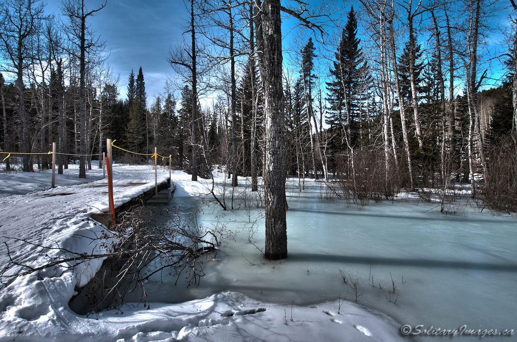
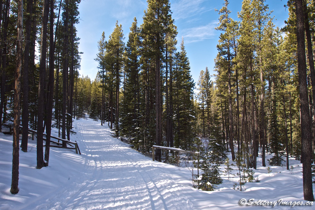
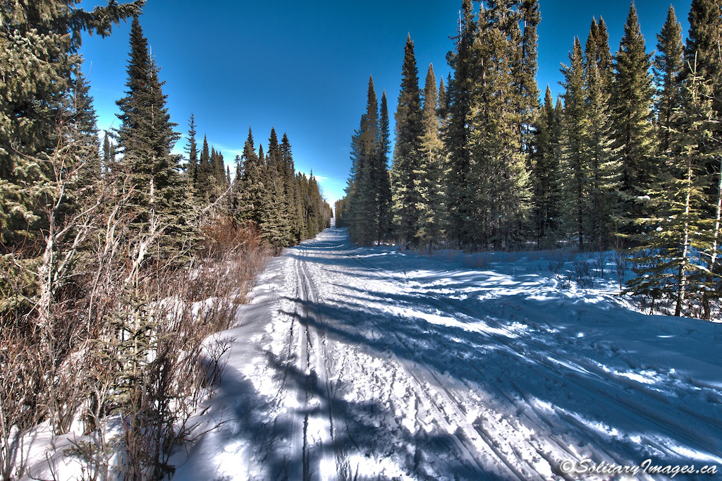
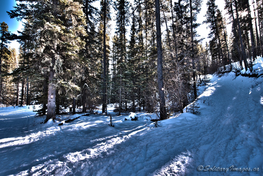
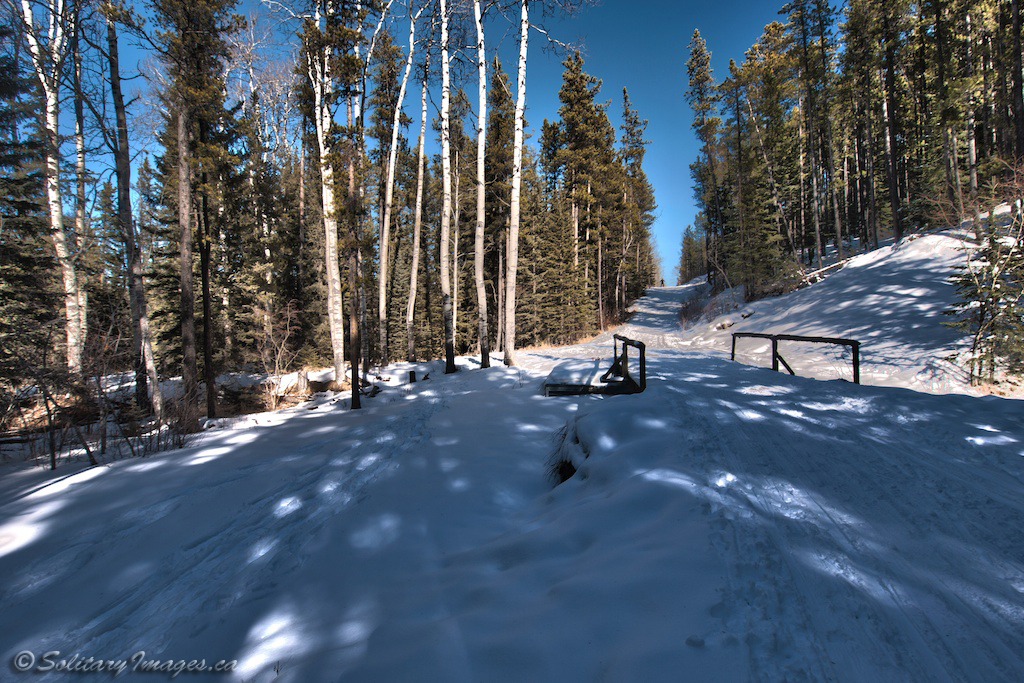
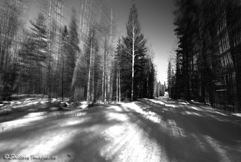
Trail Description: From Trailhead #1, take the first trail running west (away from town) on the southern edge of mountain road. This trail will parallel mountain road as it runs along the valley bottom through some scenic forests and meadows (photo #1). At just under half a kilometer, there will be a shortcut taking off to your left. (To take the shortcut, climb a short hill to a T intersection. Turn left and continue down a short hill to rejoin Crystal Line West - shortcut loop is 1.1km round trip) To complete the full loop, continue straight for another kilometer until you come to the Moose Connector Junction. Keep left and continue around as the loop makes a 180 degree turn and starts back towards the car on a fun straight line with short hills (photo#2). There will be numerous trails intersecting from both sides as you continue west. Keep straight until the trail merges left with Sundog Loop and heads down to the parking lot. As the trail flattens, you'll reach a 4 way intersection. Turn left to return to the parking lot or continue straight through for Crystal Line East.
|
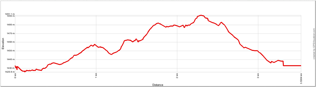
Distance: 3.5km
Elevation Gain: 60m Total Elevation Gain: 90 m Physical Difficulty: 1/5 Technical Difficulty: 1/5 Time: 0.4 - 0.8 Hr 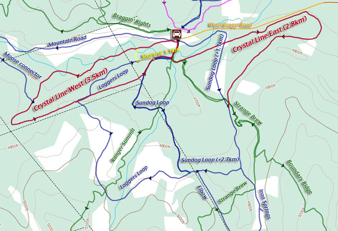
Crystal Line East and West shown in red
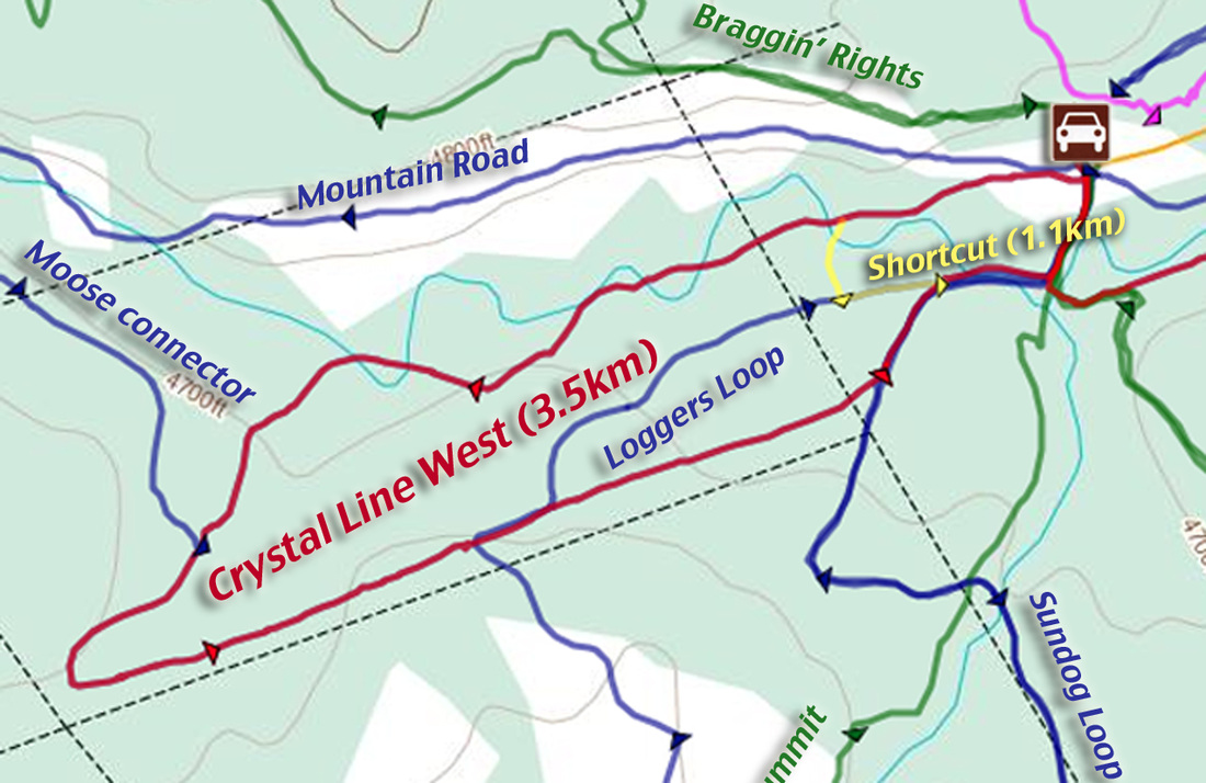
Crystal Line West shown in red. Shortcut is Yellow
|
Crystal Line East
Another popular ski trail on with short ups and downs and few turns. A great addition to Crystal Line West or numerous other trails in the area.
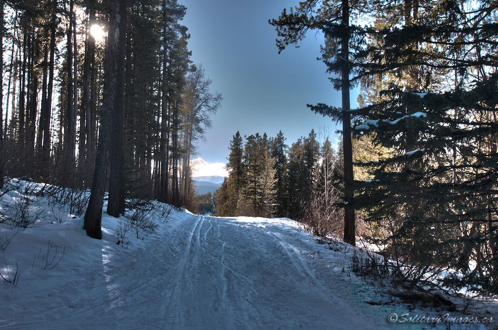
Trail Description: From Trailhead #1, head south and cross the Bragg Creek Bridge. At the four way intersection (photo#2), turn left and follow Crystal Line East as it crosses another bridge and heads up a short hill (photo #3) . Enjoy a long straight line with fun short hills as you head west, crossing over Sundog loop and paralleling Centre Ave. At the end of the line you'll do a long climbing turn and continue climbing until summiting at the junction of Sundog Loop. From here if you turn right, it is just over 1km back down Sundog Loop to the parking lot. If you continue straight on the longer portion of Sundog Loop it'll be another 2.7km and a great descent back to the parking lot. You can also add Loggers loop from this portion of Sundog, for another great descent.
|
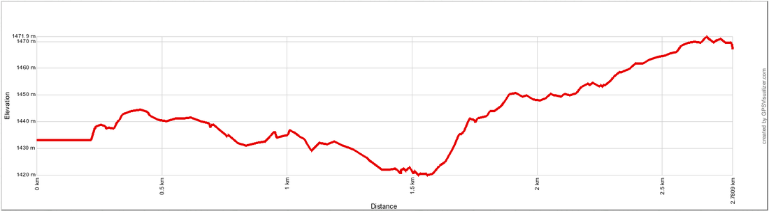
Distance: 2.8km one-way
Elevation Gain: 38 m Total Elevation Gain: 76 m Total Elevation Loss: -40 m Physical Difficulty: 1/5 Technical Difficulty: 1/5 Time: 0.3 - 0.6 Hr 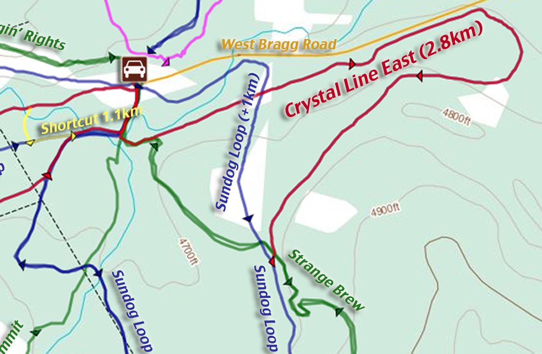
| |||||
go to West Bragg Creek Nordic Trails (click here)
go to Nordic Ski & Snowshoe Areas (click here)
go to Nordic Ski & Snowshoe Home (click here)
go to Nordic Ski & Snowshoe Areas (click here)
go to Nordic Ski & Snowshoe Home (click here)