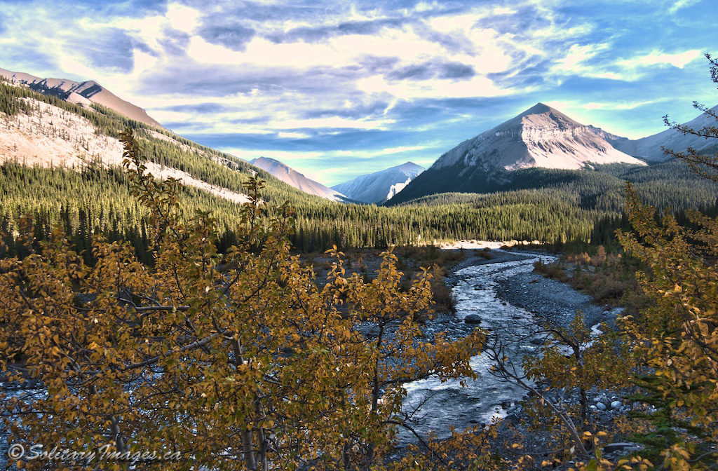
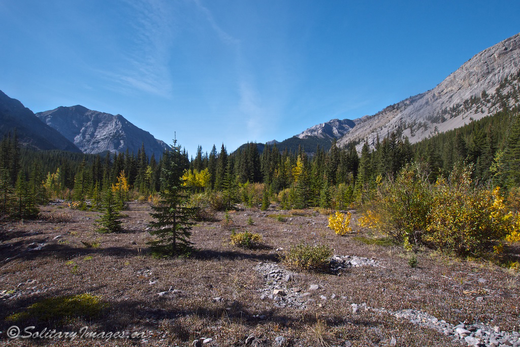
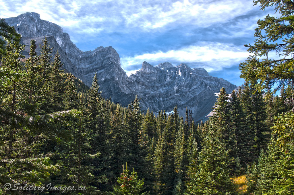
Get back to what camping used to be. Pitch a tent in the middle of the wilderness and enjoy dreams of furry fellas cuddling up with you. The Kananaskis back country offers some of the most breathtaking camping spots in the world, but you have to work to get there.
There is no vehicle access to these tenting sites and there are limited spots available. BackCountry permits are required for all designated backcountry campgrounds. Random backcountry camping without a permit is allowed in most Wildland Provincial Parks (excepting Sparrow Hawk and Memorial Lakes areas) and Provincial Forest Lands.
If you plan on having a fire, please check Alberta Fire Bans, to see if there are any restrictions first.
Permits can be purchased at the Elbow Valley Visitor Information Centre, Barrier Lake Visitor Information Centre and the Peter Lougheed Provincial Park Visitor Information Centre during normal hours of operation. Call for info: (403) 678-3136 or toll free in Alberta by dialing 310-0000 first. An additional non-refundable reservation fee applies to all advance and telephone bookings.
The following info is a rough guide only. Maps, compass, guidebooks, a knowledge of wilderness navigation and big game awareness, is essential.
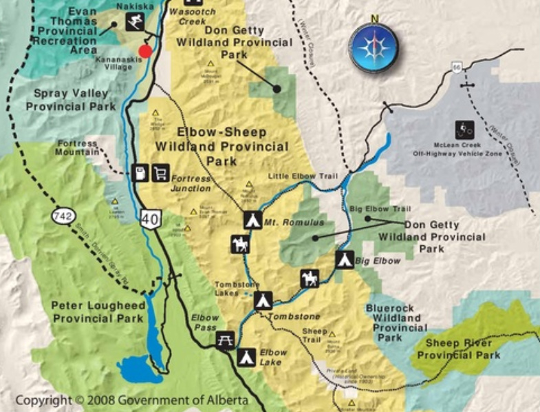
Elbow Valley Backcountry Campgrounds
Map(s) produced by Kananaskis Region | Parks Division | Tourism, Parks and Recreation Ministry, Government of Alberta
| Click to Download Interactive Map |
|
Big Elbow - This campground is located on the Big Elbow trail 9.2km from the Little Elbow Recreation parking. It can also be accessed via Elbow Pass. This route is 19.6km long. It follows Elbow Lake Trail 7.3km to Tombstone Campground and Big Elbow Trail for 12.3km. There are 6 sites, picnic tables, river water access, toilets, firewood/firepits and 4 storage lockers.
|
|
|
Mount Romulus - Located on Little Elbow Trail. This campground is 11. 9km from the Little Elbow Trail. It is accessed via Little Elbow trail. You can also access it from Elbow Pass 17. 7km. It is 7. 3km down Elbow Lake Trail to Tombstone Campground and 10. 4km down Little Elbow Trail. There are 14 sites, picnic tables, river water access, toilets, firewood/firepits and 10 storage lockers. This site also has a storage container for horse feed.
|
|
|
Tombstone - This campground has a remote feel but relatively good access. It is located at the junction of Big and Little Elbow Trails. It is 7. 3km from Elbow Pass via Elbow Lake Trail. You can also access it from either Big Elbow Trail 20. 3km or Little Elbow Trail 22. 9km. There are 11 sites, picnic tables, river water access, toilets, firewood/firepits, and 6 storage lockers. This site also has a storage container for horse feed.
|
|
Elbow Lake - This site is accessed via a short hike 1. 3km down Elbow Lake Trail from Elbow Pass. There are 15 sites and 10 storage lockers. Picnic tables, lake water access, toilets and firewood/firepits are provided. Open June 15 - November 30
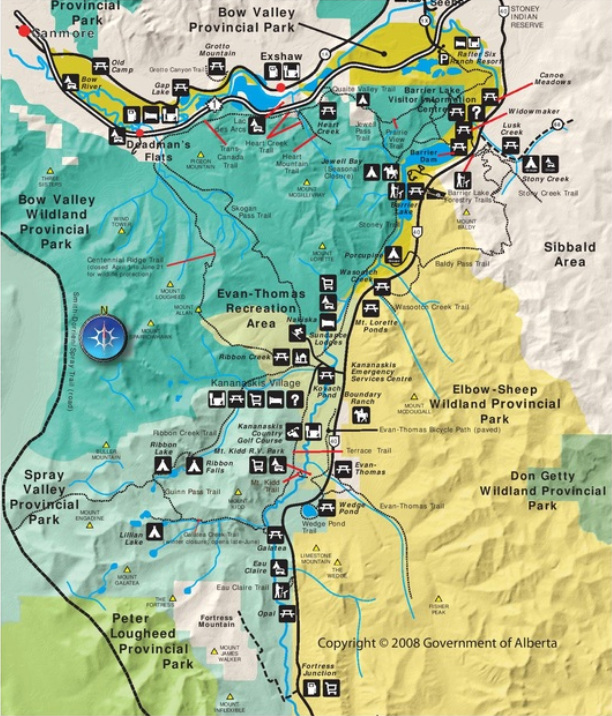
Kananaskis Valley North Backcountry Campgrounds
Map(s) produced by Kananaskis Region | Parks Division | Tourism, Parks and Recreation Ministry, Government of Alberta
| Click to Download Interactive Map |
Quaite Valley - There are two routes to reach this campground. The shortest route is 4. 7km (300' elevation gain) along Quaite Creek Trail from Heart Creek Day Use Area. Alternatively, from Barrier Dam, you can hike the Trans-Canada Trail to Stoney Trail to Jewell Pass to Quaite Creek Trail. This route is 8. 6km (720' elevation gain). There are 20 sites with 8 storage lockers, picnic tables, River water access, toilets and firewood/firepits.
Jewell Bay Equestrian - For the shortest route, from Barrier Dam Day Use Area, hike or ride 3. 9km (150' elevation gain) on the Trans-Canada Trail and Stoney Trail. You can also access this area from the Heart Creek Day Use Area along Quaite Creek Trail and Jewell Pass Trail 9. 4km (1020' elevation gain). This Campground provides 7 sites with 8 storage lockers, picnic tables, lake water access, toilets, firewood and firepits.
Ribbon Falls - Located 8. 2km (1125' elevation gain) up Ribbon Creek Trail from Ribbon Creek Day Use Area. There area 10 sites with 10 storage lockers. Picnic tables in the cooking areas, river water access, toilets, firewood and firepits are provided.
Ribbon Lake - As far from the highway as one can get in this area. Three trails of similar length all end at this campground. From Ribbon Creek Day Use Area, Riboon Creek Trail is 10km (1875' elevation gain). From Galatea Day Use Area, Galatea Creek Trail and Guinn's Pass Trail is 9.4km (2610' elevation gain). From Buller Mountain Day Use Area, Buller Pass Trail is 9.2km (2110' elevation gain). Ribbon Lake has 20 sites with 10 storage lockers, picnic tables in the cook area, lake water access, toilets, firewood and firepits.
Lillian Lake - A shorter 6. 3km (1425' elevation gain) hike from Galatea Day Use Area on Galatea Creek Trail. Or a longer 14.9km (2,760' elevation gain) hike from Ribbon Creek Day Use Area along Ribbon Creek Trail, Guinn's Pass Trail and Galatea Creek Trail. This area had 18 site with 16 storage lockers, picnic tables in cook area, lake water access, toilets, firewood and firepits are provided.
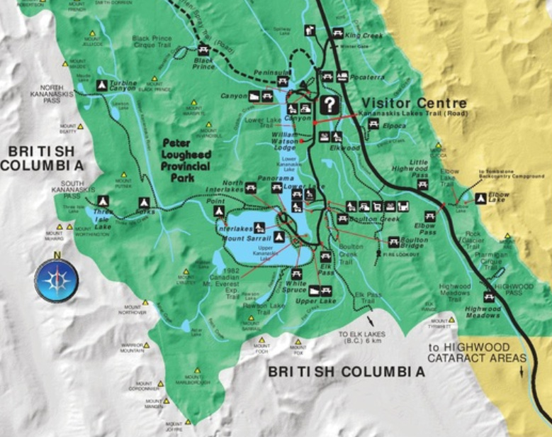
Peter Lougheed Provincial Park Backcountry Campgrounds
Map(s) produced by Kananaskis Region | Parks Division | Tourism, Parks and Recreation Ministry, Government of Alberta
| Click to Download Interactive Map |
Point - For the shortest access, hike 3. 4km on the Upper kananaskis Lake Circuit from North Interlakes Day Use area (75' elevation gain). You can also access this site from the Upper Lake Day Use Area via the Upper Lake Circuit 7. 6km and 150' elevation gain. There are 20 sites with 16 storage lockers. Picnic tables, lake water access, toilets and firewood/firepits are provided.
Forks - Located on the way to Three Isle Lake, this campground is 7. 3km from the Interlakes Day Use Area via the Upper Kananaskis Lake Circuit and Three Isle Lake Trail (300' elevation gain). There are 15 sites with 16 storage lockers. Picnic tables, lake water access, toilets and firewood/firepits are provided.
Three Isle Lake - From the North Interlakes Day Use area, a 10. 3km (1500' elevation gain) hike on the Upper Kananaskis Lake Circuit and Three Isle Lake Trail, brings you to this campground. Situated next to Three Isle Lake you'll find 16 sites with 16 storage lockers, picnic tables, lake/creek water access and toilets. No fires are permitted.
Turbine Canyon - Located next to North Kananaskis Pass, deep in Kananaskis Country. Getting here involves a 15. 1km (1575' elevation gain) hike from North Interlakes Day Use Area. Take Upper/Kananaskis Lake Circuit to Three Isles Lake Trail to Maude-Lawson Trail. There are 12 sites with 12 storage lockers, picnic tables, river water access and toilets. No fires are permitted.
Aster Lake - From Upper Day Lake Day Use Area, hike 10. 8km (1650' elevation gain) along the Upper Kananaskis Lake Circuit and Aser Lake Route to this alpine campground. Here you'll find 5 sites with 8 storage lockers, river water access and toilets. No fires are permitted.
go to Campground Areas (click here)
go to Bragg Creek Campgrounds (click here)
go to Canmore & Spray Lake Campgrounds (click here)
go to Ghost Area Campgrounds (click here)
go to Highway 40 Campgrounds (click here)
go to Highwood Campgrounds (click here)
go to Peter Lougheed Campgrounds (click here)
go to Sheep River Campgrounds (click here)
go to Sibbald Campgrounds (click here)